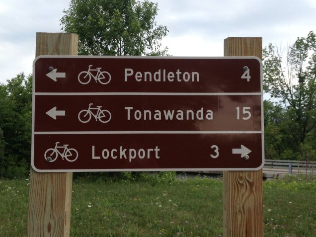
I mistakenly said, in my last post, that we had walked to North Tonawanda when we actually walked to Amherst. In the city, it’s difficult to discern where one city ends and another begins.
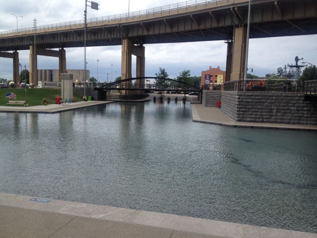
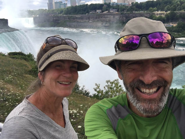
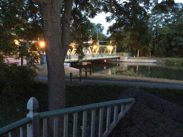
I’m writing this a few days after Day 26 and our arrival at the waterfront in downtown Buffalo. This eastern terminus of the trail is located in an area called Canalside.
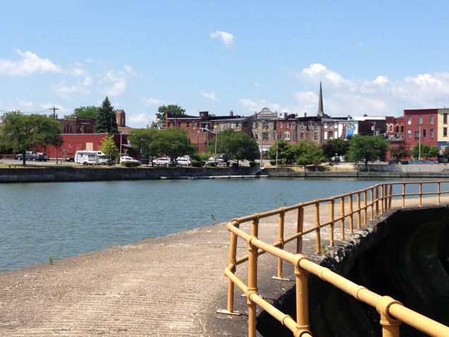
Canalside in Buffalo, NY
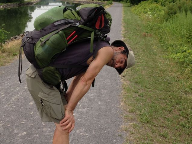
This was the longest and most challenging stretch of the walk. We walked about 22 miles. The trail in Amherst and Tonawanda meandered through parks and affluent neighborhoods but eventually led us next to oil refineries, under and along freeways, next to the city of Buffalo’s sewage treatment plant and crumbling (yes, crumbling) brick factories of old. The trail was maze-like as it wound its way towards Buffalo. At one point we came to a locked gate with a sign that said this section of the trail was only open Monday - Friday. We were there on Saturday. It gave a street to use instead. We also had a long detour at one point.
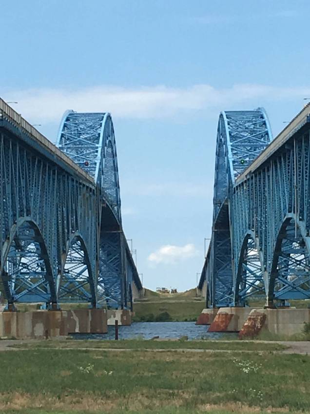
Walking beneath huge blue freeway bridges which go to Grand Island
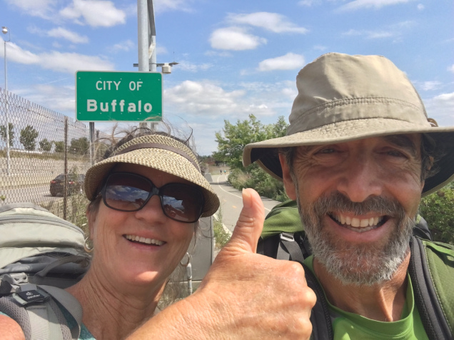
It was close to 6pm when we reached Buffalo, hot, tired, thirsty, and just pooped. The streets were mobbed with people as it was Buffalo’s annual “Rib Fest.” The festive feeling in the air was rejuvenating and just what we needed
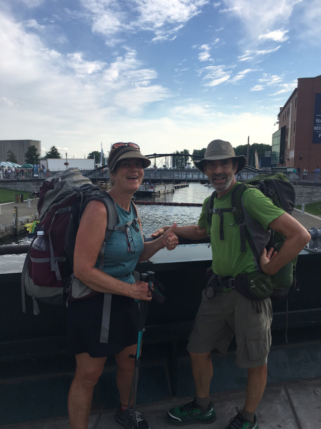
Coming into Buffalo. The sign is on the freeway next to us.Finishing our Erie Canal walk in Buffalo, NY
Thank you for your encouragement and well wishes sent along the way. This was a challenging endeavor and we were, many times, carried along by your words and reflections.
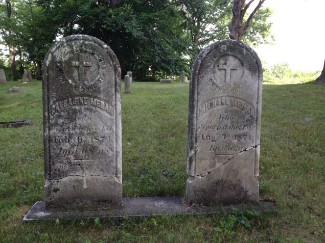
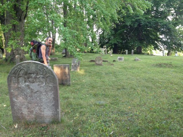
We had to walk a mile and one half to rejoin the Erie Canal trail this morning. Our route took us immediately from the busy road our motel was on to a country road lined with fields of bush beans and a horse ranch. Traffic was light and it wasn’t long before we came upon a pioneer cemetary. It was not marked by a sign indictating its name, nor was there an access road to it. There was no where to park. Although many of the stones were toppled or broken, some were standing, with names and dates readable. Most of the dates indicated that the deceased had been born in the early 1800’s and lived till the late 1800’s. The cemetary is mowed by someone and a quick Google search called it the Calvary Cemetary, owned by the Roma Catholic Church of Lockport and set to be restored. The first Erie Canal opened in 1825 making many of the folks in this cemetary first generation canal residents.
Cemetery, Summit Road, Lockport, NY
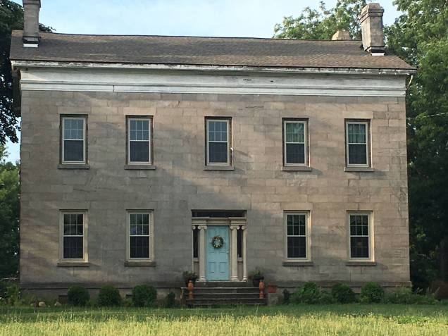
This amazing stone house was very near the cemetary and is where the horses lived.
Stone House, Summit Road, Lockport, NY
The trail towards Tonawanda/Buffalo begins with rural farming residences, changing to rural residences, giving way to to suburban neighborhoods, with four lane boulevards lined with Home Depots and Rite Aids swallowing it all. We are staying on the latter. Urban Trail Trivia: the number one piece of litter is discarded cigarette cartons.
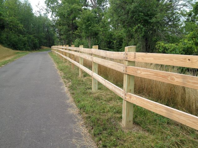
Erie Canal signature fence
This is a picture of the trail early this morning. The official fence along the Erie Canal Trail is constructed as seen above. I’ve contemplated the reason behind the design for many, many miles now. These are my conclusions, in order from the least likely to most likely. Initially, I thought they had forgotten to put in the third rung, then I came to a more meaningful conclusion. The open space, where the ‘missing’ rung is, represents the canal and the rung just above it represents the towpath where mules and horses pulled the boats and barges. A more practical reason for its design is that it makes the trail identifiable if one is not sure where they are…this happened for us today when we weren’t sure which way to go; we saw the fence and knew the correct way to go. The last rationale is purely economical. The canal system would save 25% on the cost of the fence runners by leaving one off.
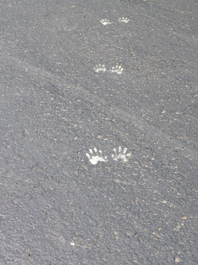
Here are a few other things we saw today.
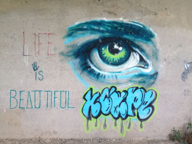
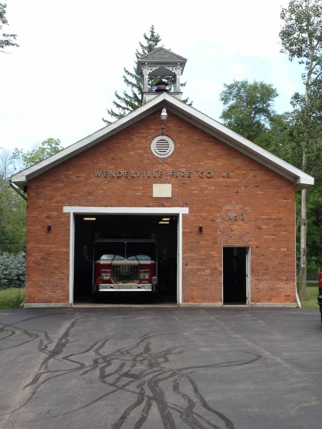
Mileage signUncle G’s ice cream standThe cutest footprints in the world! What made them?!Freeway underpass; I hope the artist is in art school!Wendelville Fire Department in 1862 school house
We experienced a slight feeling of melancholia today knowing that after tomorrow we would be saying goodbye to the canal and trail that have been our home for the last month. The trail has provided a consistent way forward, strewn with a variety challenging challenges, meant to exercise our commitment and endurance, as well as many open, generous, and heartfelt human exchanges, meant to strengthen our belief and trust in the goodness of the human community. We are also ready to be finished and look forward to returning to Bellingham. I will likely post a few times after we finish. I will take no offense if anyone wishes to unsubscribe from receiving this blog after The Erie Canal Walk concludes. My future posts will likely be focused on walks closer to home.
I forgot a couple tidbits I had intended to include yesterday. We thought this was an interesting moment. At this spot, we are very close to Lake Ontario, maybe 8 to 10 miles. Neither of us have seen Lake Ontario but hope to next week. You can really see the absolute lack of shade in this section. In a word: brutal.
Sign says it all…
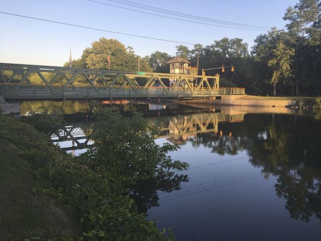
We read this on the lift bridge in Holley. We are guessing that the lift bridges are more than 100 years old. How cool , right!?
Holley Lift Bridge plaque
Today…
We walked about 18 miles today. It was long, hot, and muggy but we made good time, arriving in Lockport around 2pm.
Long day…
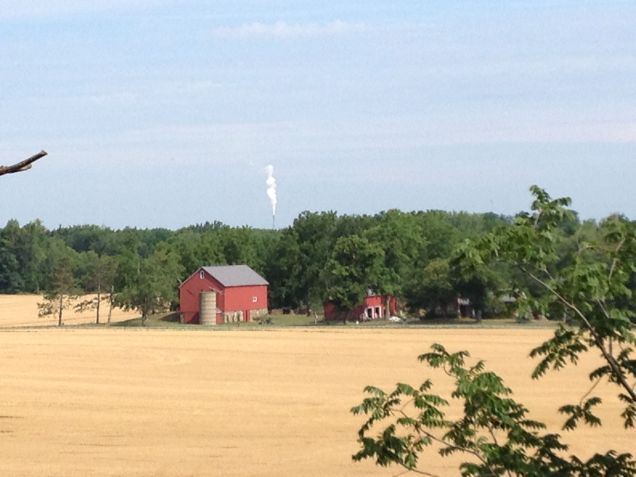
We saw more apples today and this smoke stack, which must been at Lake Ontario. It was SO tall.
Apples in Northwest NY StateSmoke stack at Lake Ontario; typical farm in Upstate NY
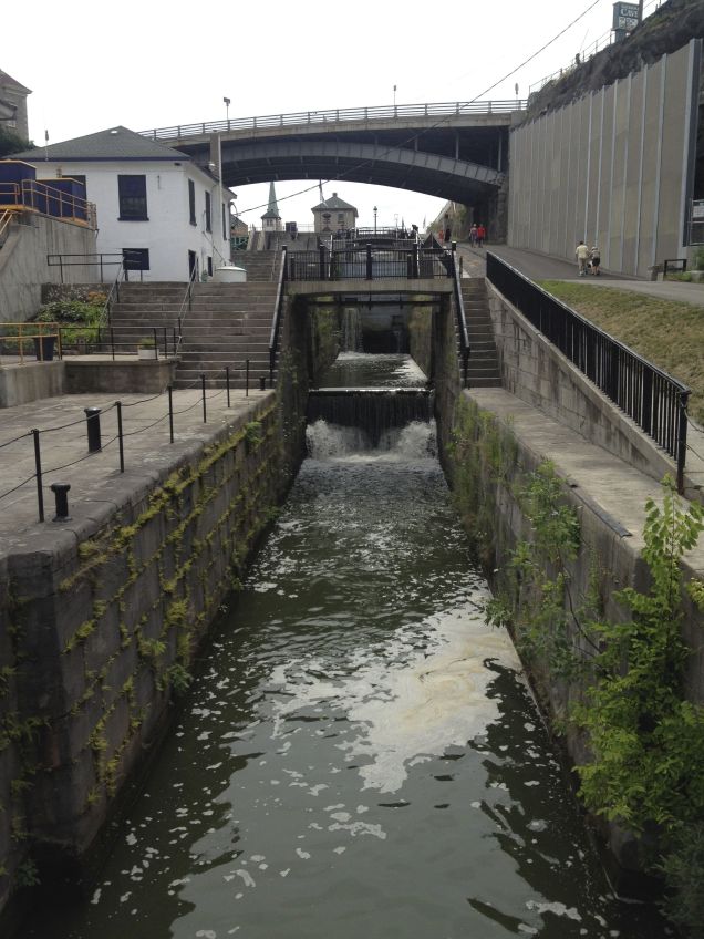
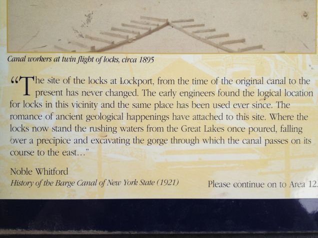
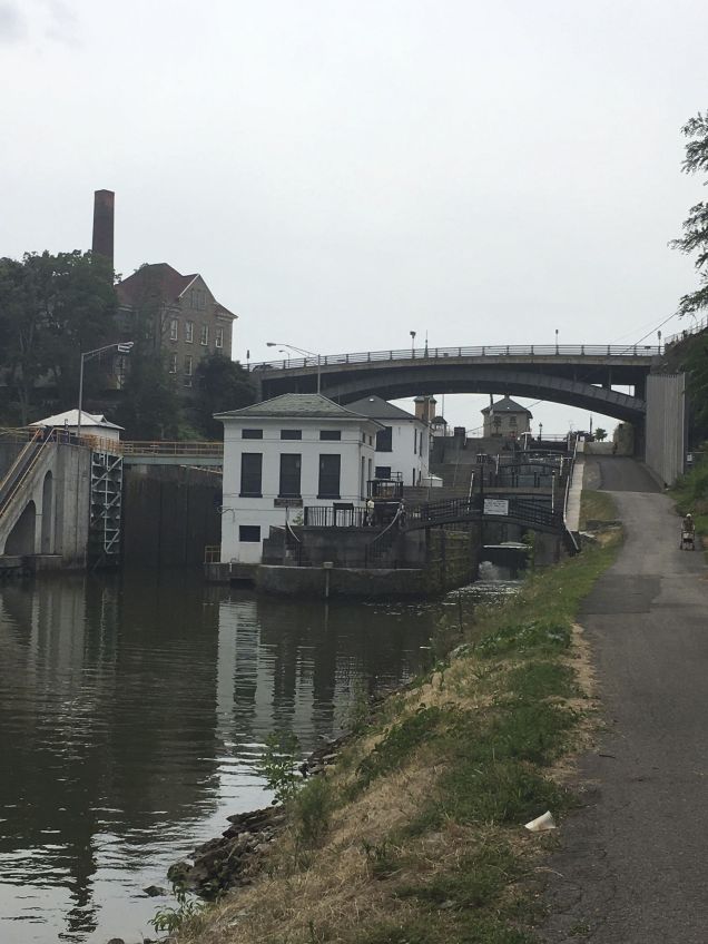
Lockport is home to the “flight of five,” which refers to the series of five side by side locks built to climb the Niagara Escarpment, a 70 foot high cliff of sedimentary rock. The double locks enabled boats going opposite directions to keep moving. They remind me of escalators. The city has restored one side of the original locks while the other was enlarged to accommodate modern watercraft. Here’s a little information.
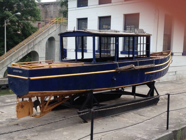
Early locks at Lockport, NYA little info…Another buoy boat…so cute!Base of locks at Lockport
This video is a little grainy but give an idea of the sound and sites.
Error
This video doesn’t exist
I’m so glad tonight is the last night of the DNC. Since we are on the east coast, we are watching in real time. President Obama began speaking around 10pm our time. We are staying up way too late to watch, but who wouldn’t want to watch our beloved president give his final address to our nation?
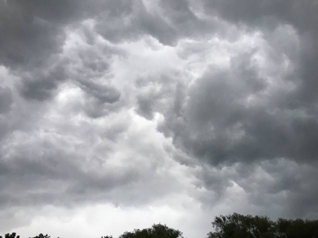
Our day off in Holley was restful even with the heavy rain that began early in the morning and persisted, on and off, well into the afternoon. Our tent, the Big Agnes Copper Spur 2 ultralight, is performing beautifully. Upstate New York is proving to be an excellent testing ground for tent performance. I was dry and cozy, reading away, while the thunder growled and roared overhead with the rain pouring down. New York rain storms can come and go, suddenly and fiercely, like a shower being turned on and off. We’re getting better at reading the sky and preparing accordingly. Here’s a picture of the dramatic stormy sky.
Thunderstorm clouds
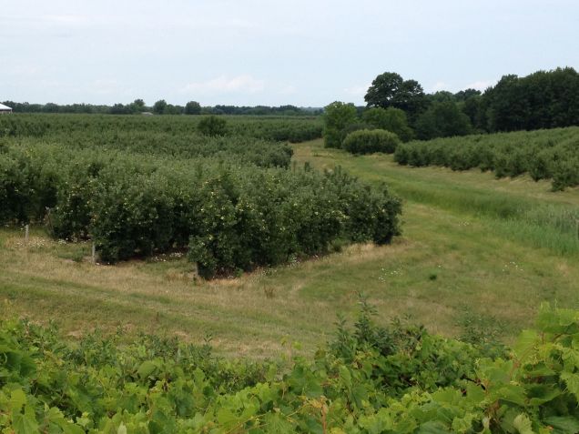
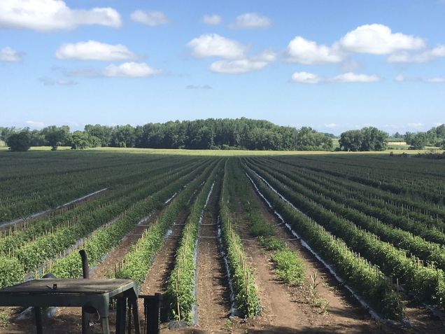
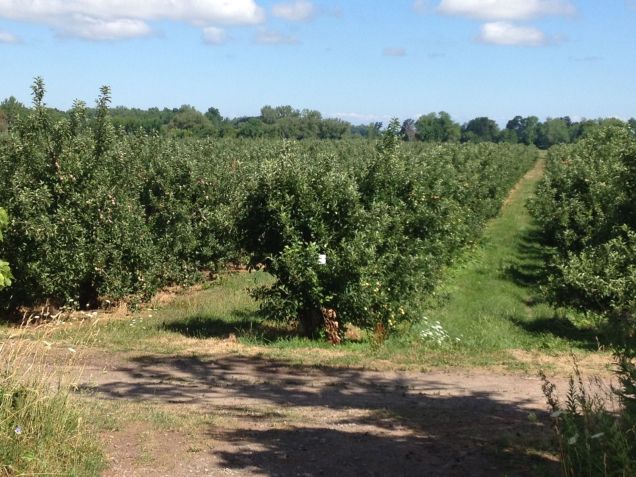
The stretch between Rochester and Buffalo has become quite agricultural with the leading crops being corn, apples, and cabbages. We have also seen tomatoes and what I believe were eggplant. Fields of food stretch as far as the eye can see, filling us with gratitude for the farmers of the world. As we walked this morning, we reflected on the farmers of upstate New York who, at least for our west coast experience, have been eclipsed by the celebrity of New York City, a city which owes its fame and success to the ancestors of these very farmers and canal laborers. We are learning that there is so much more to New York than the Big Apple.
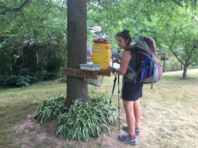
Never pass up free ice water! AKA “trail magic”Tomato field in Upstate NY. Note the meticulous staking of the plantsApple OrchardThe light green through the trees is a cabbage field
Albion to Medina…
We left Albion 6:55am to beat the heat. There isn’t any shade over the trail anymore. We are glad we are walking west with the morning sun at our backs. I don’t think I’ve mentioned the constant headwind that we are walking against. We are appreciative of it as it provides much needed ‘convected coolness.’ We stayed about a mile from the trail last night and on our way back to the trail this morning we walked right pass a NY State correctional facility in Albion. All I can say is that it was a sight to see.
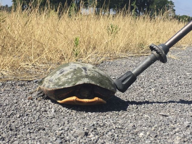
We have seen a bit of wildlife in the last few days, including a fox, a groundhog (the canal’s enemy…think holes), several river otters, a tree FULL of turkey vultures (I counted 15 from across the canal), and a snapping turtle who wouldn’t come out of his/her shell, no matter how nicely Aaron asked or how gently I nudged it with my walking stick.
Shy snapping turtle
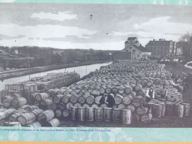
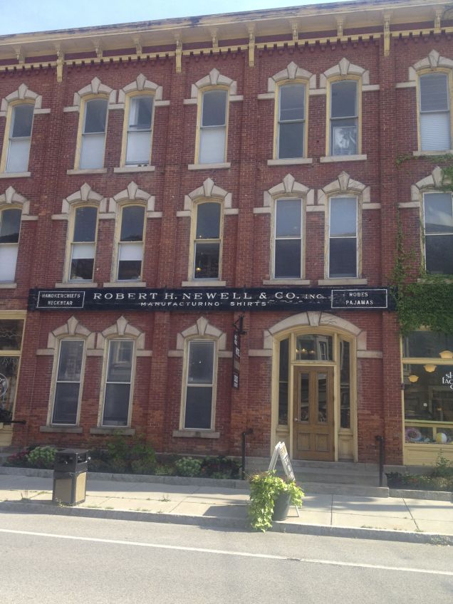
Medina (pronounced with a long “i”) is famous for its apples, sandstone, and the Robert H. Newell shirt manufacturing company. In the early days of the canal, Medina apples were shipped as far as Africa. Barrel makers, from nearby Knowlesville, called ‘coopers,’ crafted the finest barrels from oak and metal. This is a picture of the Medina harbor covered with barrels of apples awaiting shipment down the Erie Canal to NYC and onto ships bound for distant continents.
Medina apples bound for ports around the globe
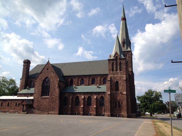
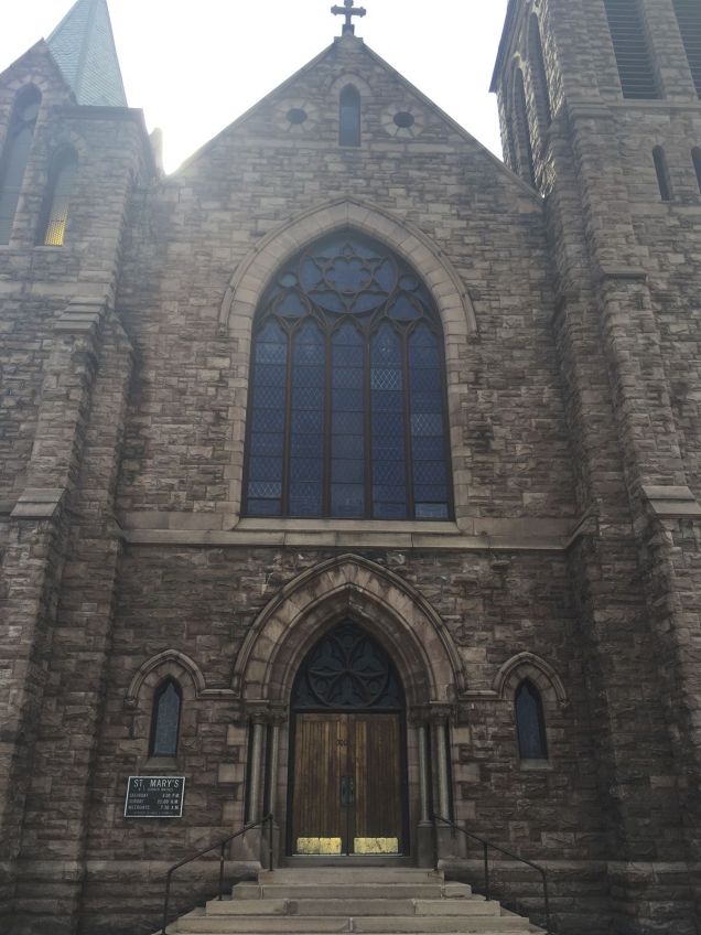
Medina sandstone became the building material of choice during the growth of towns along the canal. We read that there were many sandstone quarries in this area. The stone proved strong and abundant. On our stroll around Medina this afternoon, we measured sidewalk pavers measuring 7 x 11 of my feet. So the sidewalks were/are sandstone and all the curbs are granite. Here is St. Mary’s Church made of Medina sandstone. It is utterly magnificent. Medina sandstone is also found along the trail under bridges.
The steeple of St. Mary’s rises above the town. We always see the steeples first when coming into a town.St. Mary’s built out of Medina SandstoneThe front of St. Mary’s, Medina, NY
Robert Newell made shirts in Medina for celebrities such as Bob Hope and Winston Churchill. His factory is now home to the Hart House Hotel and we are staying here tonight!
Robert H. Newell shirt factory building, now a boutique hotel
We have three days of walking to finish this walk. Our next stops will be Lockport, Tonawanda, and Buffalo. We are ahead of schedule, which gives us a little time to explore the greater Niagara Falls/Lake Ontario area. We have decided to rent a car in Buffalo, camp near Lake Ontario for a few days, and take day trips to see the sites! We’re very excited to be finishing!
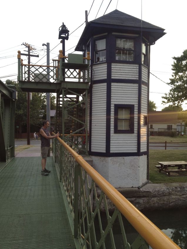
After a leisurely morning at Adams Basin Inn, we walked about eleven miles to the tiny village of Holley where there are campsites for boaters, bikers, and hikers. We will stay here two nights, taking a rest day. We are camped right next to another lift bridge! I’m sure one grows used to the wonder of watching the whole bridge lift, but not us. We are still captivated by them. We had a long conversation with Jane, the lift bridge operator about the history and operation of the lift bridges.
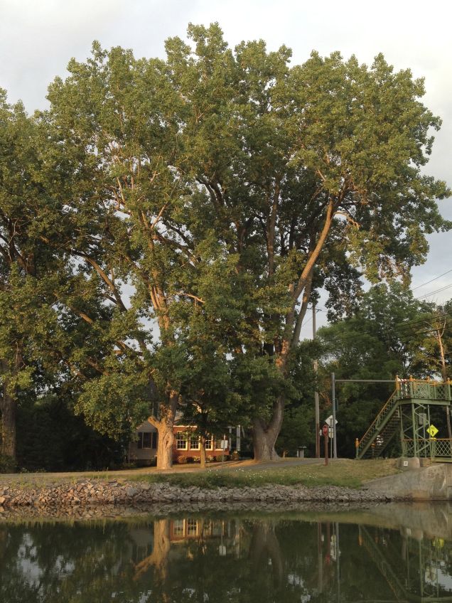
Massive Tree at Holley, NY. The house below is two-story and the tree just towers above it.
She explained that the bridges were built a long time ago and were not constructed for amount and kinds of traffic they are serving now. Heavy trucks, loaded with gravel or stopped traffic on the bridge, are taxing the bridges beyond their abilities. Increased boat travel has the bridge going up and down more frequently and operators, pressured to get to get car traffic moving, raise and lower the bridge too fast, basically slamming it down into its fittings. The bridges are so charming to tourists but impact the lives of locals. Coming through Brockport yesterday, where there are two lift bridges, one of them was not working. Car traffic was stopped intermittently and boat travel was just stopped. They couldn’t raise the bridge. When we got to Holley, there were boats waiting for the bridge to open.
Monday…
We woke to big thunder and lightening and rain. We put all our gear in the tent, put on rain gear, buttoned down the hatches, and headed for the local diner for breakfast. Well-needed rain is expected all day so we will likely be in the diner for a while. ( :
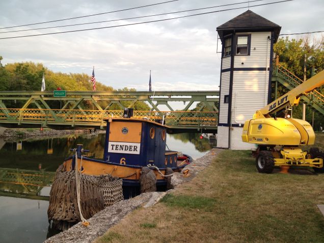
Operator’s tower at the lift bridge in Holley, NYTender the Tug at Holley, NY
Here’s a short video of the Holley harbor. The orange and white tent is ours. Aaron is filming from a gazebo and I am warm and dry in the tent, reading and listening to the rain fall.
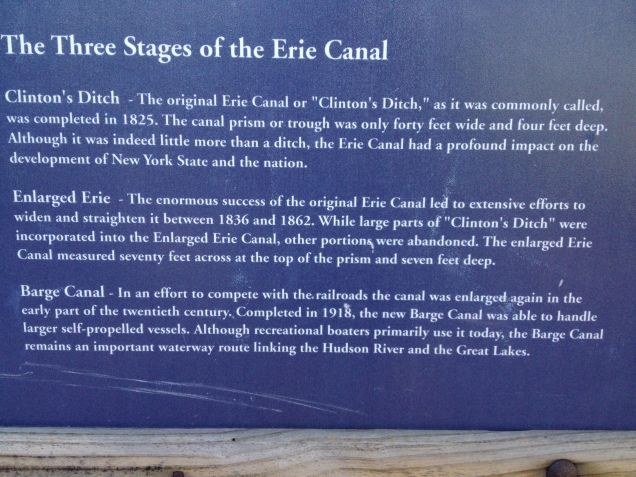
Here’s a little info on the “Three Stages of the Erie Canal.”
A bit of information
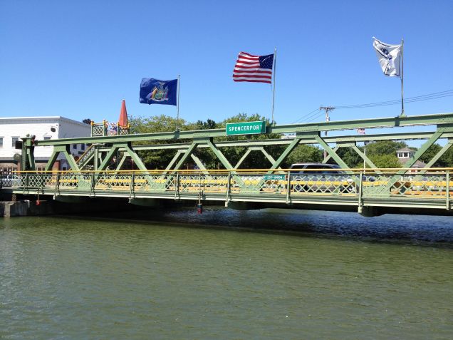
We saw our first lift bridge in Spencerfort and had lunch here before walking on to Adams Basin.
Spencerfort Lift BridgeAdams Basin Lift Bridge with lights on
The day dawned blue and clear promising temps into the 90’s. Fortunately, the humidity was low and we made good time walking the eleven miles to the canal side village of Spencerport. We had lunch at Cafr Machiatto and then the nice ladies who made us an amazing lunch, let us stash our backpacks behind the counter while we walked over the market to get a picnic dinner. We are staying about 3 miles west of Spencerport in Adams Basin tonight at the historic B and B, Adams Basin Inn, situated a stone’s throw from the canal. The house is reportedly the last remaining original tavern and inn on the original Erie Canal…one of 1500 taverns in operation when the canal was used for transporting cargo. Our innkeepers, Dave and Pat, have run the inn for the past ten years. They were exceedingly welcoming to us despite our dusty shoes and sweaty brows. The house and bar have been restored, giving one an authentic experience of days gone by. Dave treats all his lodgers to a history lesson about the house and the canal in general. Pat is very nutrition conscience and creates wholesome delicious breakfasts, She also treats her guests to homemade chocolate chip cookies. We feel very fortunate to have lodged here. There is a lift bridge right on the canal at the inn. There are sixteen lift bridges on the barge canal. The one at Adams Basin is the third we’ve seen. There are two up ahead in Brockport and one at Holley where we will camp on Sunday.
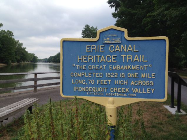
We met and were passed by numerous joggers, walkers, and bikers as we set out from Bushnell’s Basin to the canal side area of Pittsford, approximately three miles west, where we planned to have breakfast. The increase in trail users is another stark contrast to the walk east of Syracuse, where we could walk for miles and miles and not see another person. Much of this stretch, known as The Great Embankment, is where a 70-foot embankment was constructed in order to carry the canal above the Irondequoit Creek Valley. Another feat of incredible ingenuity, to say the least.
Trail from overpass at Pittsford.Great Embankment sign
After leaving Pittsford, where we had a yummy breakfast at Coal Tower Cafe and were showered with much appreciated accolades about our walk, we set off for our city walk on the trail through Rochester. It was hot and muggy and only getting hotter and muggier with rain in the forecast. But we had some neat experiences and views despite fairly challenging weather. We saw this boat that I believe can be chartered. It seems such a peaceful way to travel.
Error
This video doesn’t exist
We passed by Locks 32 and 33. This is 32 draining to allow two tiny boats traveling west, to enter.
Error
This video doesn’t exist
Error
This video doesn’t exist
Error
This video doesn’t exist
This last boat was a real treat as it was the paddle wheel boat we saw days ago while camping at lock 21. I got excited and tried to tell them that we had seen them before. I’m not sure they understood me but we were very happy to see this sweet little boat go by us again.
Error
This video doesn’t exist
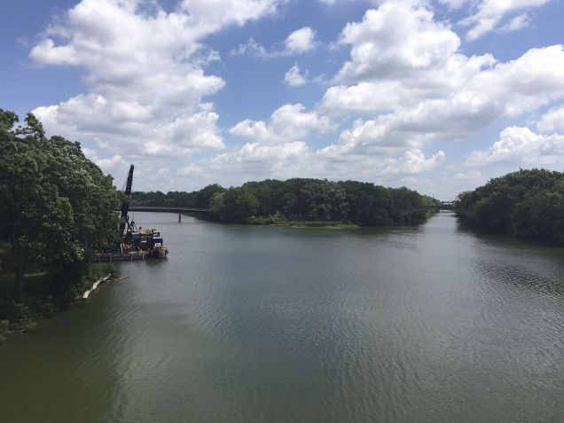
We had a few bikers tell us to use caution as we went through Genesee River Park in Rochester, that it might not be safe. I’m sure this park, like all big inner city parks can be dangerous at times, but we found it to be an oasis in the midst of freeways, airport, and trains. The Genesee River runs north-south through Rochester, while the Erie Canal runs east-west. These two waterways intersect in the park.
Intersection of Erie Canal and Genesee River in Genesee River ParkGenesee River, Syracuse, NYFiltered Sunlight in Genesee River Park, Syracuse, NY
We’re staying at a hotel just off the trail near the airport. For dinner we had the traditional Rochester, NY dish called “garbage plate.” It consists of meat, home fries, and macaroni salad all smothered with gravy. It was fabulous, especially after a long walk! Between the park, the canal, and our ‘garbage plate,’ we’ve had a real Rochester experience. We’ll walk to Adams Basin tomorrow and stay at the historic Adams Basin Bed and Breakfast.
We’ve been able to camp the last couple nights, which makes it more difficult to write. Even though we’ve tented at campgrounds with wifi, the dynamics of camping require my focus elsewhere. I’ll attempt to catch up a bit here.
We took a taxi (no public transportation) from Weedsport to Lyons and then walked on to Newark. This is another section of unfinished trail where you are directed to walk on a busy hiway for about 20 miles. It is exceedingly uncomfortable for me to have semi trucks barreling at me 6 feet to my right, and since we came to walk the trail, we decided to bypass the hiway bits. We still walk on country roads in many places. Plus we got to meet Hank, our taxi driver, a single dad of a thirteen year old boy. His wife passed at an early age, leaving him and his son. Hank’s story and desire to raise an upright and well-rounded man was moving and inspiring.
We have been following the original Erie Canal for miles and miles but at Lyons the trail rejoins the modern barge canal, the Erie Canal’s third, and so far, final evolution. We had parted ways with the barge canal at lock 21 where it continues north to Lake Oneida. The old and new are actually paralleling each other now. That means that we see more boats and go through more towns with harbors and canal side commerce. I want to say a bit about the area we bypassed before moving on. This area is now called the Montezuma National Wildlife Refuge and is a major flyway for migratory waterfowl on the east coast. During the building of the Erie Canal, however, it was called the “Great Cayuga Swamp.” Workers on the canal contracted malaria from mosquitoes and the disease proved fatal for approximately one thousand workers.
This is a sign we saw coming out of Camillus. I forgot to post it on the last post. Unfortunately, we didn’t have any stowaways.
Sign leaving Camillus Erie Canal Museum…we didn’t even see a cat! ) :
We camped in Newark at Whispering Winds RV Park. It was quiet and clean. Newark has a nice harbor for cruisers on the canal. Here is our campsite in the early morning with low lying fog.
Whispering Winds Campground Campsite
Heading west out of Newark, we came to an area called the “wide waters” which appears to be a fisherman’s haven. Many houses dotted the banks, each with a dock.
We found a little cafe right off the trail in Palmyra, appropriately named “Muddy Waters.” East of Lyons, a trail side cafe would have been rather rare but since rejoining the barge canal and being in closer proximity to major metropolitan areas, we have enjoyed this convenience a few times. Anyway, Palmyra is the 1820’s birthplace of Mormonism, where Joseph Smith unearthed golden plates containing the Book of Mormon. Palmyra was dubbed the “queen of the canal” in its heyday. We camped at Red’s RV Park just west of Macedon, NY, having walked a whopping 18+ miles this day.. Red had an awesomely refreshing in-ground pool!
We walked about 14 miles today to a suburb of Rochester called Bushell’s Basin just east of Pittsford. There was an abundance of canal activity today and I managed to get Coral, my mini iPad, out of the pack in time to take some videos. I hope they stream well for you. The first is a canal cruise line boat. This is the first of two identical boats going east.
Error
This video doesn’t exist
This is women’s crew team practicing on the canal. This was a real treat! Girls rock!
Error
This video doesn’t exist
We had lunch in Fairport, a canal side village dubbed the “Jewel of the Canal.” Fairport has wisely capitalized on the charm of the canal. Shops and restaurants line the canal way and the whole area seems very welcoming and prosperous.
Lunch at the Towpath Cafe, Fairport, NYComing into Fairport, NY
Fairport has a “lift bridge,” which historically enabled the passage of tall loads being moved on the canal. During lunch, we were treated to two liftings of the bridge. The first video shows the bridge lifting while the second is the boat that came through. It is a very low bridge, typical of the bridges of old. There was construction going on in front of the cafe, hence the men without shirts. ( :
Error
This video doesn’t exist
Error
This video doesn’t exist
After Fairport, the canal meandered through posh residential neighborhoods.
Canal beyond Fairport, NYCanalside wildlife
Jusr before we exited the trail to find our hotel we met Norm and Larry, two residents of Fairport. They were both in their 80’s and passed us a couple times as they sped up and down the canal trail in their motorized scooters. When they stopped to talk to us, they told us how proud (yes, proud) they were of us that we weren’t taking our ability to walk for granted. I had been feeling somewhat weary and just plain tuckered out earlier in the day, and their words were just the encouragement and perspective I needed. Not all trail angels provide food and drink for the body. Some give sustenance for the soul. Here are trail Trail Angels Norm and Larry.
Norm, Larry, and Ann
Tomorrow we will walk through most of Rochester and stay near the airport. How’s that for a change of scenery? I have begun to miss Mexican and Thai food. Pizzarias are to New York as Starbucks are to Washington…one on every corner. We had a first today…a car with New York license plates actually stopped for us while we were waiting at a crosswalk…sorry New Yorkers, but it’s true. We still love and appreciate you. ( :
We left Syracuse at 6 am…to beat the sun or the rain, whichever came first. The village of Camillus is unrivaled in its dedication to restoring the section of the old Erie Canal that passes through their backyards. The museum was still closed when we came through but there is much to see outside. First of all, they have mileage markers, a real help when wondering where you are. This one indicates we are half way between Albany and Buffalo.
Half way point between Albany and Buffalo!!
Here are a couple canal boats. The bouy boat was used by a canal worker to change out the kerosine lamps that lined the canal, allowing passage at night.
House BoatBouy Boat
The village has restored The Nine Mile Aquduct and claims that it may be the only working aquaduct in the country.
Nine Mile Aqueduct, Camillus, NY
We met these 3 gals, Holly, Bernie, and Diva. They were awesome.
Holly, Bernie, and Diva
These are for Nancy. We had lunch in her home town of Jordan. It’s a village really and very lovely.
Jordan Middle SchoolJordan Village Hall
Well, the rain came first, in bucketfuls, just about 1/2 mile from our lodgings in Weedsport. Our shoes are drying, once again, in the sun that came out just after the soaking rain.
Marie was born in Canastota and has lived all her life in the area. She was the school librarian for many years in Canastota at the very school she attended as a young girl. In fact, when she retired from teaching, she was working in the same room in which she had attended kindergarten. Now, that’s a story!
Marie picked us up at our hotel and proceeded south through town. She pointed out Nathan Roberts’s home on the the way to Chittenango. Marie took our picture on the “yellow brick road” in Chittenango, home of Wizard of Oz author, L. Frank Baum. Yay!
Yellow Brick Road
Then we went to the Erie Canal Museum in Chittenango. Even though it was closed, we could see the dry docks where canal boats could be repaired. The triad of docks looked like three-sided swimming pools into which a boat could be moved. After a boat entered a dock, the water was drained out allowing the boat to rest on wooden supports while being repaired. When the repairs were finished, the pool was refilled with water and the boat was ready to renter the canal. The three pools could be operated independently of each other. These were the forerunners of the car pits mechanics work in today. I’m sorry we don’t have a picture of them. Here is the canal at Chittenango.
Chittenango Canal Museum
From Chittenango we went to see the Butternut Creek aqueduct near Fayetteville. The stone arches are what remain of this lovely aqueduct.
Butternut Creek Aqueduct near Fayetteville, NY
Marie then drove us right to the front door of our hotel. Imagine! We are deeply thankful to Marie, the latest trail angel in a whole host of angels, who have blessed us on this adventure.
We decided to change our earlier lodging plans in Syracuse. Instead of staying the youth hostel, which looks very nice, we decided to take advantage of an amazing grand opening offer at Aloft, on Syracuse’s inner harbor. We received a warm and welcoming greeting from everyone and when they found out that it was my birthday, they really astounded us. Aaron and were at the pool and here comes Matthew and Sarah with a huge basket, filled with local products, representative of the local bounty and industry. At one time, Syracuse was the salt capital of the country, so of course, there was Syracuse salt. There was also wine, candles, pancake mix, baked beans, root beer, garlic oil, chocolate syrup, ice cream, salad dressing, and a huge bottle of barbecue sauce. There were also free drink vouchers for use at the bar. It weighed more than my pack! Matthew said, “no problem, we’ll ship it home for you.” Minus the ice cream. 😊 Thanks to Michael, Heather, Matthew, Sarah, Kelsy, Sherry, Sherelle, and everyone else! Take a look what these very kind people put together for me.
Basket of Birthday gifts from the staff at Aloft in Syracuse, NY
Saturday, July 17…
We walked to downtown Syracuse this morning. The Creekside Trail runs from The Inner Harbor to Armory Square, the downtown area. The Erie Canal used to run down what is now Erie Street. Here is the city park that commemorates the canal. All those tall buildings are the banks that sprung up around the lucrative canal.
Erie Canal Monument in Syracuse, NY
The Erie Canal Museum in Syracuse is in the old weighlock building. It was a regular lock except for having a sling that would weigh the boat to determine the toll for using the canal. The toll was based on weight, type of cargo, and distance. There is a replica of a packet boat displayed in the old lock, although packet boats, who carried passengers, were not weighed. In this picture, you can see the pillars of the building and some of the boat.
Boat in Weighlock building in Syracuse, NY
I’ve had a great birthday here in Syracuse. We are both looking forward to getting back on the trail. Tomorrow, we’ll walk to Weedsport, hoping to see the aquaduct and museum at Camillus on the way.