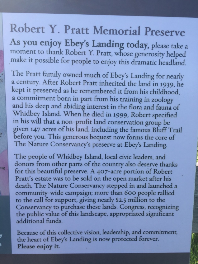
Ebey’s Landing, on the west side of Whidbey Island, Washington, (near Coupeville, Washington) is one of the last undisturbed saltwater-influenced lagoons of the Puget Sound’s coastal lowlands. Above the lagoon towers the arid bluff with its fragile plant life unique to Ebey’s and only a few other areas in the world. It is managed and protected by a number of agencies, including The Nature Conservancy. Here is a little information about that.
A little history of Ebey’s Landing on Whidbey Island, Washington
This hike has been a longtime favorite of Aaron’s and mine. In fact, we were married about a mile from this dramatic historical headland at The Jenne Farm, which is a preserved farm within the Ebey’s Landing National Historic Reserve. The ceremony was on a gorgeous day in June seventeen years ago and we all came over to the beach at Ebey’s Landing afterwards to continue celebrating and to enjoy this amazing place.
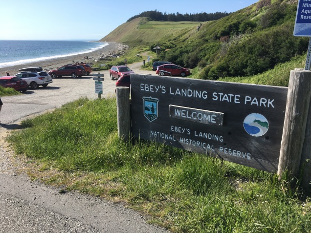
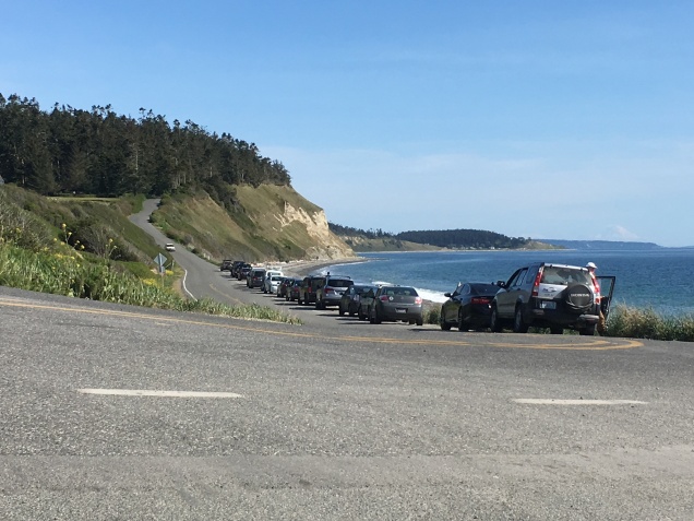
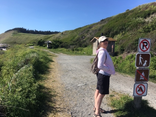
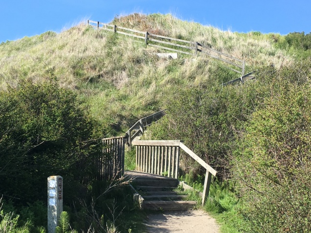
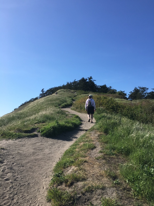
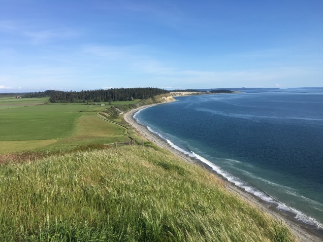
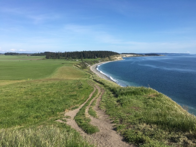
The Ebey’s Landing hike begins in the parking lot, ascends a series of steep wooden stairs to the field above, continues to climb up the bluff to a gently rolling trail along the bluff, and descends on the far end via an elaborate series of switchbacks to the beach. The hiker walks back to the parking area along the beach. We so appreciate loop trails like this one, which is 3.5 miles in total. It’s perfect for packing a picnic lunch on the beach or take the short drive into Coupeville for a steaming bowl of Penn Cove mussels after your hike. Coupeville is located right on Penn Cove, which is famous for its mussel industry. It is also just a super quaint little town. Very touristy all year long and offers a fun Musselfest in March every year andCoupeville Arts and Crafts Festival every August. Can you tell we really like it here?! ( :
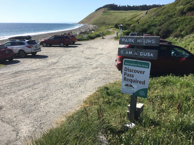
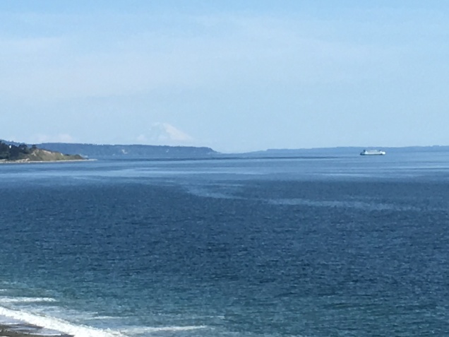
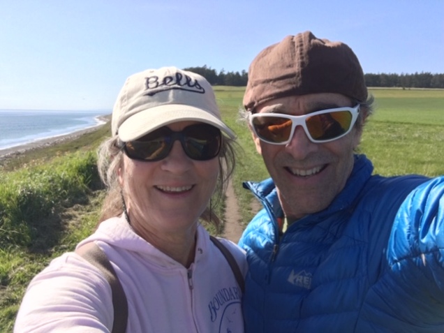
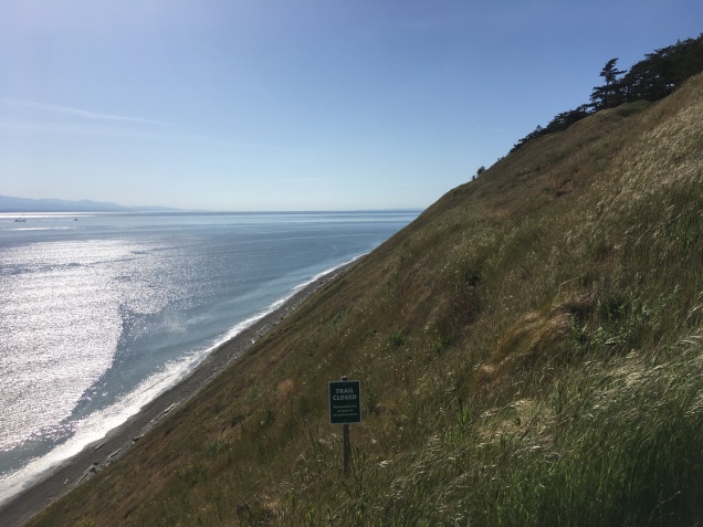
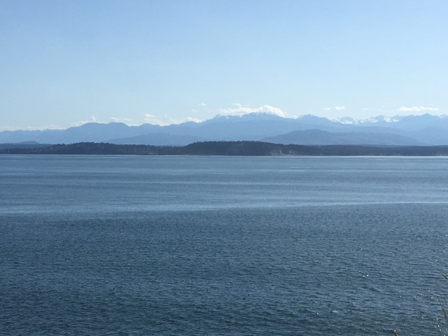
Parking Lot at Ebey’s Landing with the headland in the distanceA Discover Pass is needed to park in the lot but if you turn around, you can park on the road without one! See next picture!Road parking at Ebey’s Landing…no Discover Pass required!Aaron took the pictures for this post so I got to be in some of them! Yes, I’m hiking in my Keen sandals…easy on and off for walking in the waves!Stair climb!Ascending the BluffLooking back towards trailhead…what a view!Ferry from Coupeville going to Port Townsend with Mount Ranier in the distance. We had just crossed on this ferry coming from Port Townsend on our way home from Olympia, WA and decided to stop for a hike on this absolutely glorious day!Okay, last one of us! Aaron holds the phone and I push the button. Teamwork!The bluff is super steep!Looking straight down the bluff at the beach below. You really want to stay on the trail here!Looking southwest, across Admiralty Inlet, to the snow-capped Olympic Mountains of Olympic National Park.Looking back one more time before the parking area disappears around the bend.
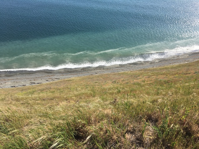
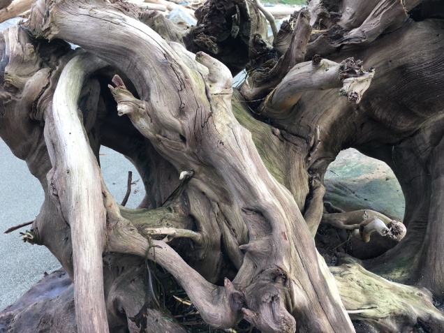
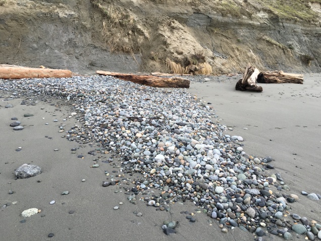
The next three pictures are Aaron’s artistic pictures of the beach at Ebey’s Landing. This hike is a great day trip from Bellingham or anywhere in the Puget Sound really. There are two campgrounds nearby, Fort Casey and Fort Ebey, plus numerous Inns and B&B’s in Coupeville, if you want to make a weekend of it. This is just as good as it gets!
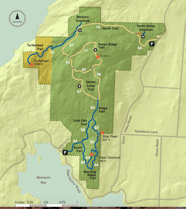
For the last few years, Aaron and I have made it a tradition of taking a long walk over New Year’s somewhere in the San Juan Islands. Last year, we walked on tiny Shaw Island and the year before that, San Juan Island. This year we traveled to Orcas Island to walk over Turtleback Mountain, which through the efforts of the San Juan County Land Bank, the San Juan Preservation Trust, the Trust for Public Lands, and more than 2,000 private donors, is one of the largest protected natural areas in San Juan County. It is comprised of 1,718 acres of woodlands, grasslands, quiet forests, and scattered wetlands. It provides the walker with the occasional fabulous view to the north, west, and south.
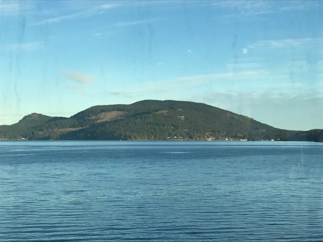
From the ferry, one can see why Turtleback Mountain was named Turtleback Mountain!
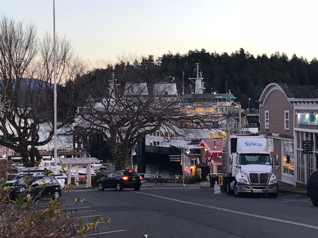
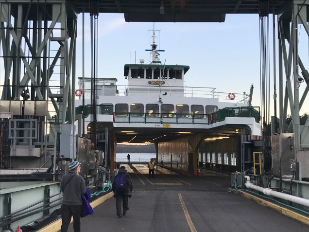
We walked on the Washington State Ferry at Anacortes bound for Friday Harbor on San Juan Island, where we lodged at the Earthbox Inn for two nights. Early in the morning on our one full day, we hopped on the smaller inter-island ferry bound for Orcas Island.
Early morning ferry in Friday Harbor, WAWalking on an almost empty ferry bound for Orcas Island.
Turtleback Mountain has two trailheads; a northern and a southern. Since we were on foot, we decided to take a taxi to the northern trailhead, through-hike to the southern trailhead, and walk back to the ferry from there. I had arranged with Eric from the Orcas Island Taxi to meet us at the ferry and drive us the 5.7 miles to our starting point. He was waiting and knew exactly where to go! Eric told us he had a big night ahead…since it was New Year’s, he would be offering free rides home to folks between the hours of 12 midnight and 2 a.m…pretty sweet of him.
The trail immediately climbs and doesn’t stop until the highest point on the Raven Ridge Trail at 1519 feet. It was a crisp, clear morning and we were soon warmed through and through by the effort this trail required. We stopped at the North Valley Overlook and could see the refineries at Cherry Point near Birch Bay and the Canadian mountains beyond. We also stopped at the Waldron Overlook, which offers amazing views of Waldron Island and beyond to the west. We skipped the Turtlehead Trail due to time constraints. We had to make it back to the ferry by 4 pm and had roughly 4 additional miles of trail walking and about 5 miles of road walking back to the ferry. From the Waldron Overlook, we chose the Raven Ridge Trail, which took us to the summit and from there it was downhill all the way to the south parking lot/trailhead.
The trail is very well marked. Even so, in addition to food, water, layers, and rain gear, I would suggest bringing a map. Be prepared for a real workout. There are very few switchbacks and the trail is steep. We experienced the kind of post hike soreness that had us going down the stairs in our home backwards for a couple days, if you know what I mean. Also, the 2.5 mile section of road walking along Deer Harbor Road back to the main Orcas Road was the kind of road walking that no one should really do and I can’t recommend. There is virtually no shoulder and many blind turns. But, we made it and in the end had a wonderful day!
Turtleback Mountain Map
We arrived back at the ferry dock about two hours before our ferry. We grabbed a sandwich from the Orcas Village Store and took it to a newly opened wine bar called Champagne, Champagne. Since it was New Year’s, the owner was serving everything bubbly. We ate our sandwich with a glass of fizzy Pinot Noir, played a few hands of cribbage, and watched the sky turn to an amazing pink. The sun had long set as we arrived back in Friday Harbor.
I’ll close with a video of our day! I hope you enjoy it as much as I do!
This post is a long time coming! Of course, there are many reasons for such a long interval between posts…a busy year, life transitions, etc. And while all of that is true, it really just comes back to an undercurrent of Fear that I’ve recently began to observe in myself. I’m pretty sure its been there all along, slinking along the sheltered recesses of consciousness, out of sight, out of mind, adding its commentary to the ongoing narrative, and ultimately having an influence on decisions and outcomes. “Surely no one wants to hear about the Chanterelle Trail (or anything else for that matter),” Fear whispered to the Walk Blogger.
This past summer, I transitioned from a busy 24/7 teaching position to a part-time shop girl job. Talk about Fear! But the image of unloading a mountain of responsibility for a simple, quiet, inward year of self-reflection and artistic exploration could not, would not, be dampened by Fear’s insidious methods. This professional “pause” is my 60th birthday gift to myself and what I’ve come to realize is that the real gift has been the space to reestablish a relationship to time, that construct that maintains order in our lives…sometimes at a cost.
Don’t get me wrong though. I have been a fast-pace junkie. I perform better, think better, and possibly feel better when cramming 30 hours into 24. You too?! Lucky for me, my teaching position provided an organic moment to come up for air and upon reaching the surface, I wasn’t just breathing, I was gulping.
So where does Fear fit into this narrative (or the Chanterelle Trail, for that matter)? I’ll get to that, I promise.
One of the benefits of increased “free time” is the opportunity to observe and reflect on oneself. Through this reflection, I have become aware of the ways in which Fear weaves itself into every day life. Some Fear is healthy Fear. “You should not walk alone on that trail under the freeway where the man was stabbed last month.” Thank you Fear. Duly noted. I wholeheartedly agree.
On the other hand, the Fear that no one would want to read a blog about The Chanterelle Trail, and possibly more accurately, one written by yours truly, is simply rubbish. So, after that long introduction, it was our first go at hiking The Chanterelle Trail that brought into clear focus the presence and effect of Fear.
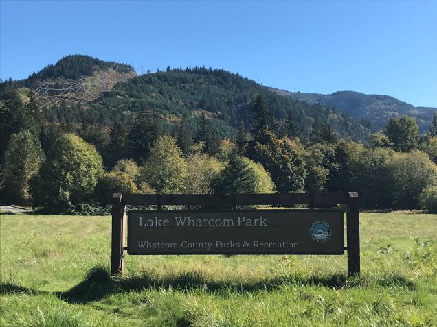
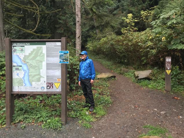
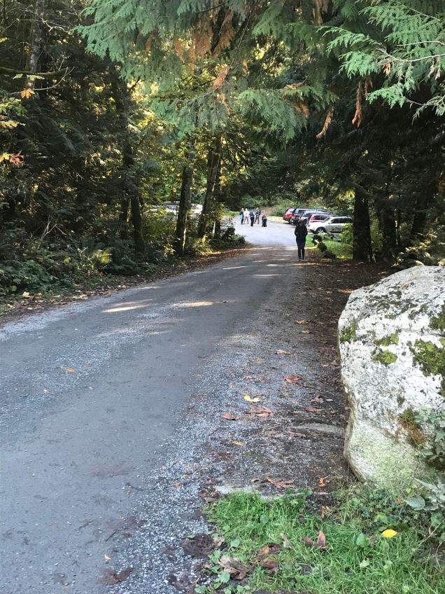
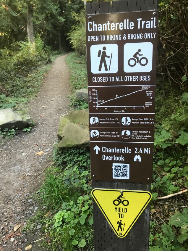
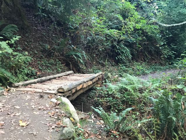
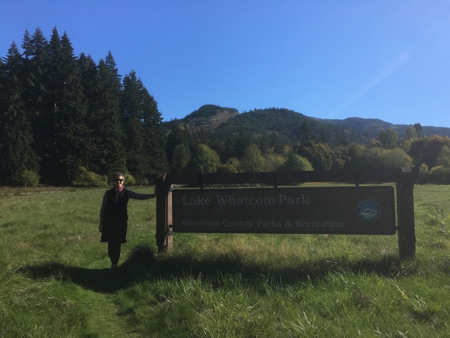
One very rainy day, about a month ago, Aaron and I decided on a spontaneous hike up the 2.4 mile Chanterelle Trail, in Whatcom County’s Lake Whatcom Park. We donned full rain gear and set out at about three in the afternoon. For some reason, we did not expect a fairly rigorous ascent in the wilderness. I think the word “Park” fooled us into believing that this would be akin to walking in Whatcom Falls Park or similar. Anyway, as this was a spontaneous walk through a “park,” we totally abandoned all the rules of setting out into the rainy wilderness late in the day and didn’t bring water, snacks, headlamps, or first aide. Nothing.
The Chanterelle Trail ascends fairly dramatically for the first quarter mile or so and then levels off to a more gradual ascent for the remainder of the hike to the lookout and turn around point. As we ascended on this rainy day, the deep dark woods slowly became deeper and darker. The sound of the wind rustling the leaves was amplified by the cover of clouds, which hung in the trees creating an eerie landscape of limited visibility and unsettling noises. Needless to say, Fear was having a heyday with my imagination and before long, I was convinced the woods were full of bears and/or cougars. In my defense, there have been many sightings of bears and cougars in the area and knowing this did not help. I was sure that with every step forward, the odds of encountering a large carnivore became greater and greater. We were about 1/2 mile from the lookout when up ahead came a loud crashing noise through the forest. Well, that’s all it took. I turned around and ran down the trail…so fast in fact that I couldn’t hear Aaron calling to me that a large branch had broken and fallen, making the crashing sound. It wouldn’t have mattered anyway. I was so hijacked with Fear that the only antidote at that point was the comfort of knowing we were heading towards the safety of the truck and home. On the ride home, we decided we would return on a sunny morning with water and snacks, which we did about three weeks later!
Rainy day at The Chanterelle Trail trailhead
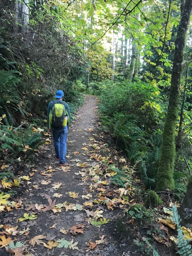
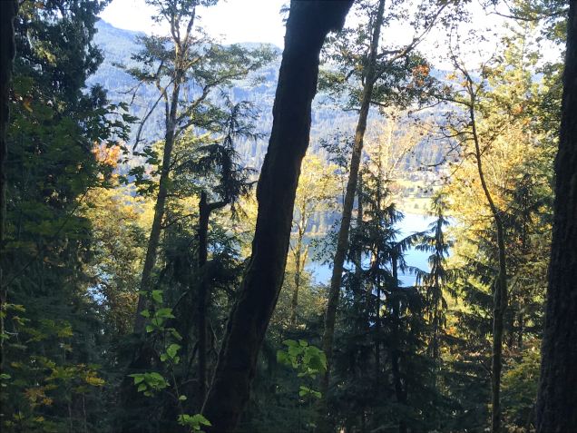
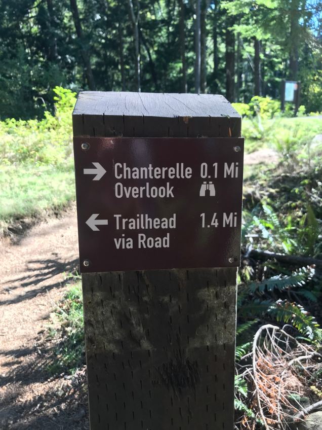
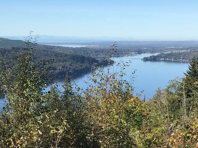
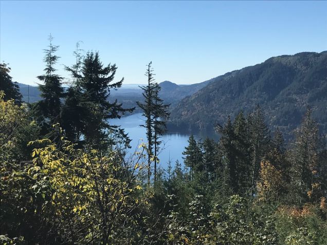
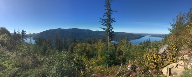
The Chanterelle Trail is a great hike for getting the heart and lungs pumping and offers an amazing view of Lake Whatcom, Bellingham Bay, and the San Juan Islands. It is 4.8 miles round trip, with 1000 feet of elevation gain to the lookout point. When we returned, the leaves were half off the trees, allowing for peek-a-boo views of Lake Whatcom.
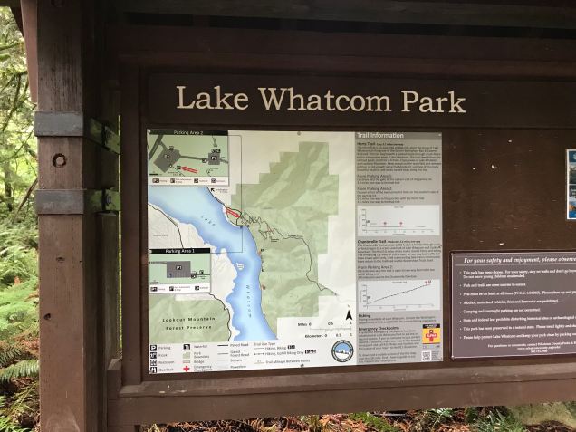
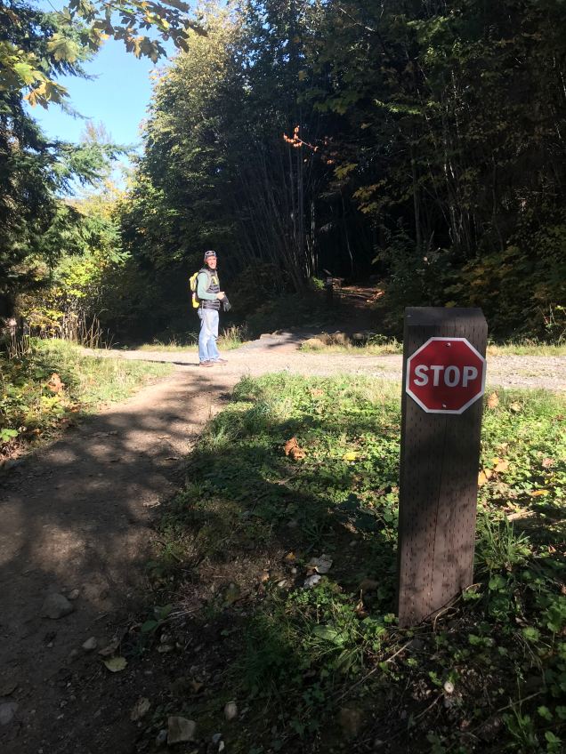
Sign and map in parking lotwalking from lower parking lot to upper lot where trail begins (already busy in the morning!)Rules of the TrailChanterelle Trail crossing Wickersham Roadlush forests line the switchbackssmall bridge over streampeak-a-boo view of Lake Whatcom on our ascentAlmost there!View looking west over Lake Whatcom to Bellingham Bay and Orcas Island in the distance!Looking south over Lake WhatcomAaron’s panorama of both previous photos with Lookout Mountain directly across lake.
Our second hike was successful! We sat at the top for a while, eating our bananas, drinking our water, soaking in the stunning views without a trace of the Fear that so punctuated our last attempt. I’ve thought about that Fearful day many times since then. There may have been a bear or cougar nearby. My Fear may have been spot on. I’ll never know. But what I do know is that all one has to do is turn on the TV or radio or open the newspaper to totally justify a heightened sense a Fear in our lives. I had just begun to write this post earlier in the week before going to a yoga class with Amy at 3 Oms Yoga in Bellingham. It was election day and Amy talked about Fear in her opening words, which was incredible given that I had just been writing, quite candidly, about my experience with Fear. One thing she said resonated with me and helped me bring balance to this experience. She said, and I paraphrase, Fear does not define us. It is not who we are. It is an experience we are having and because we can look it at it objectively, talk to it, and ask it questions, we are able to discover what Fear is trying to tell us about ourselves and the world. Somewhere I knew this but it was good to have it offered in this way. Amy’s words brought normalcy and a sense of wholeness and unity to the experience. I was no longer alone in my Fear.
If you’ve read to here, thank you! I usually don’t share such personal reflections and thoughts in my posts. I wonder what insights our next walk will offer! Stay tuned!
Aaron and I hiked to Park Butte Look Out last weekend. This is a busy place! At 10am, we pull into the very last spot in the large parking lot and consider ourselves lucky. After all the parking spots have been filled, hikers park on both sides of Forest Service Road 13 for quite a way, perhaps 1/4 mile. Our rough estimate is that about 75 cars parked at the trailhead on this sunny and warm Saturday in August. Most groups of hikers were two or more. Add to that a Washington Trails Association workparty at the look out and a pack train of mules and horses transporting supplies to another workparty, and one can easily imagine the constant hum of foot traffic on the trail. Imagine also, every hiker with a bright smile, rosy cheeks, moist brow, and lungs full of autumn-tinged alpine air and you have imagined a perfect day for hiking on the southern slopes of Mount Baker in the north Cascades of Washington State.
The first section of the trail winds its way through Schrieber Meadows, which was bursting with ripe mountain blueberries. We found out that it is very difficult to walk and pick blueberries at the same time! In this area, much of the trail is elevated on wooden walkways to protect the sensitive meadows beneath.
Schrieber’s Meadow
The Washington Trails Association maintains a ladder bridge across Rocky Creek. The creek is the color of milk chocolate from the sediment it carries on its way to Baker Lake.
Rocky Creek and ladder bridge
Did you know that a female mule is called a molly? That’s what the leader of this back country pack train told me. They were bringing supplies to a trail crew up ahead. I didn’t catch his name, but his molly’s name was Emily and she was lovely.
Emily, the molly leading the pack trainBackcountry packtrain at Morovitz Meadow
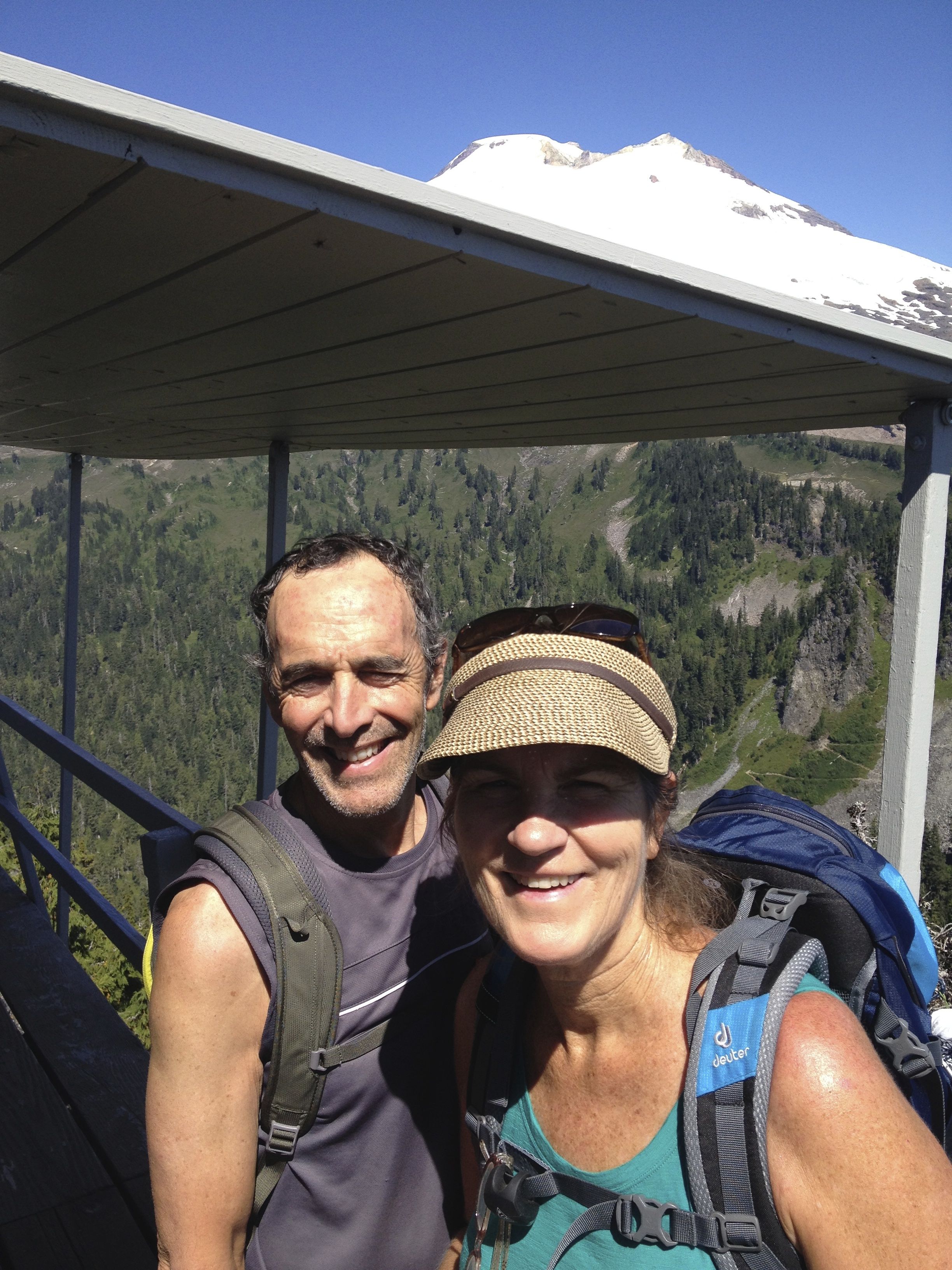
The elevation gain from the parking lot to the look out is 22oo feet in about 3 3/4 miles. The last push to the look out is pretty steep and a little eerie if heights aren’t your thing. The 360 degree views are fabulous. You can sleep in the look out on a ‘first come, first serve’ basis. The work crew, who were painting the look out, trumped hopeful backpackers the day we were there. But there were plenty of other camp sites nearby; either at Cathedral Camp or at a small tarn, where I went swimming.
Park Butte Look Out from belowPark Butte Look Out with Mount Baker (and us!)
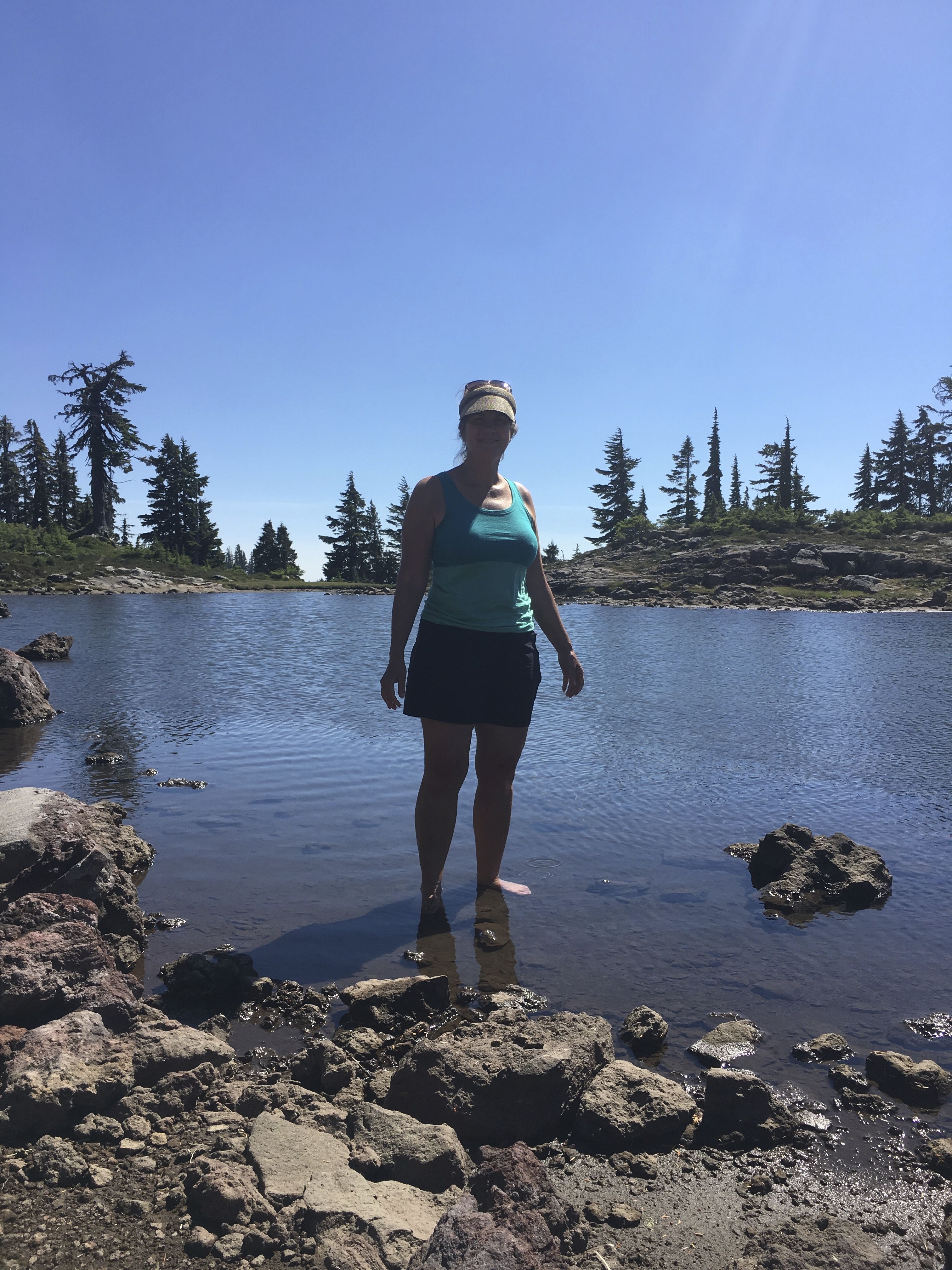
After descending from the Look Out, we walked over to a small unnamed tarn, had lunch, washed off trail-dusty legs, soaked feet, and I took a refreshing dip!
Washing off the trail dustSmall tarn in saddle under Park Butte Look Out
This is Cathedral Camp where backpackers can find many campsites and a pit toilet. Unfortunately, there is no water nearby. The above tarn is the closest water source. There were many tents there when we started down at 4pm and backpackers were still arriving! Bring your earplugs if you plan to camp here!
Cathedral Camp from above
This was a stunningly beautiful hike. Between the mountains, wildflowers, blueberries, sunshine, tarn, and pleasant company, the only thing we were missing was our overnight backpacking gear.