The Bellis Fair Mall Walk

Early Morning at Bellis Fair Mall, Bellingham, WA
Early Morning at Bellis Fair Mall, Bellingham, WA…welcoming the Mall Walker Community

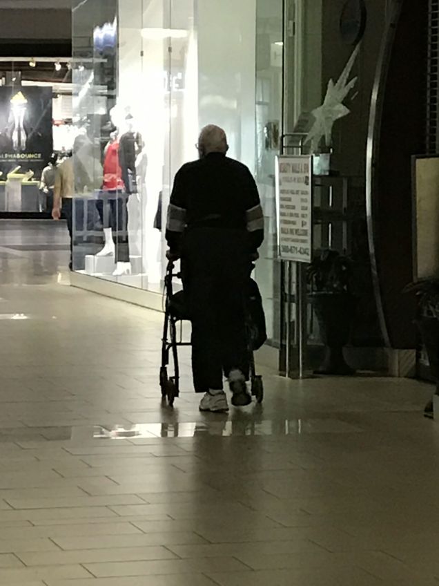
Have you ever gone to the mall to walk? Before this week, the idea of mall walking was a fuzzy concept for me, hovering somewhere between “I’ve heard of it” and “you’ve got to be kidding.” I might have even rolled my eyes and chuckled at the thought. Well, my experiences of the past two days have totally humbled me. I am now a champion of mall walkers everywhere and their mission to maintain and enhance their physical and emotional health and well-being by taking advantage of this clean, warm, indoor venue for walking.

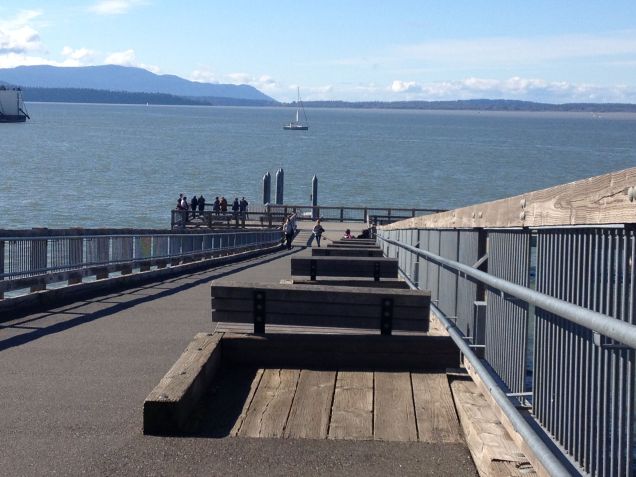
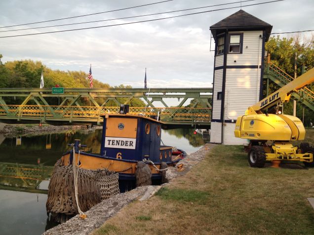
Strong winds are common in the Northwest’s Puget Sound, making walking in our thickly wooded parks and streets, a bit risky. These strong winds frequently topple trees and any wind advisory means walkers should stay out of the woods until the winds calm down. It was this scenario, a few days ago, that gave me the idea to try mall walking and I wasn’t the only one! There were probably 50 – 75 seasoned mall walkers there. All ages. All abilities. All cool.

Family of three walking at Bellis Fair Mall
These people were MOVING! I thought they would lap me twice, and I'm no slowpoke! ( :
These people were MOVING! They lapped me once and I thought they might lap me twice, and I’m no slowpoke! ( :
Mall walking is awesome for those needing an even surface
Mall walking is awesome for those needing an even and stable surface
This gal pushed a stroller with her two dogs. Sometimes they walked and sometimes they strolled.
This gal pushed a stroller with her two dogs. Sometimes the dogs walked and sometimes they rode. Pretty sweet.
As people warm up, they leave their coats and hats on the food court chairs
As people warm up, they leave their coats and hats on the food court chairs and keep on moving!
Apres-Walking social time at Starbucks, open at 7 am
Apres-Walking social time at Starbucks, which opens at 7:30 am, in the food court
A train of walkers in Bellis Fair Mall

Tips, Suggestions, and Observations from Two Mornings of Mall Walking:

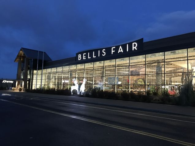
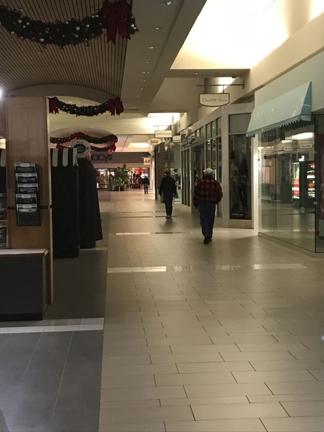
  • Our local mall, Bellis Fair, opens its doors at 7 a.m., year round, Monday – Saturday, to provide a warm and welcoming space for walking. It is located just north of Bellingham, at the intersection of Meridian Street and I-5.
  • There is mall walking etiquette. Everyone walks anti-clock wise. I suppose you could walk clockwise but no one did.
  • Mall walking is an inclusive and social atmosphere. People greet you and say ‘good morning’ and seem genuinely happy.
  • I walked during the holidays, so the music was 100% Christmas. I’m thinking the music is normally soft rock.
  • Some people had ear buds in, listening to news, music, books on tape, This American Life, or whatever. Great idea!
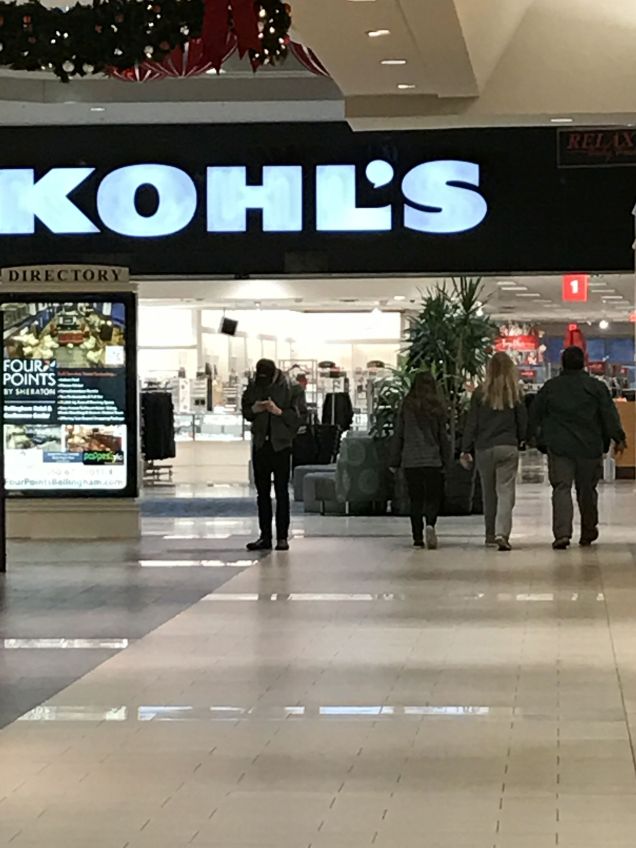
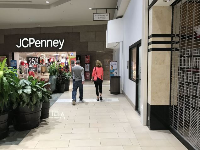
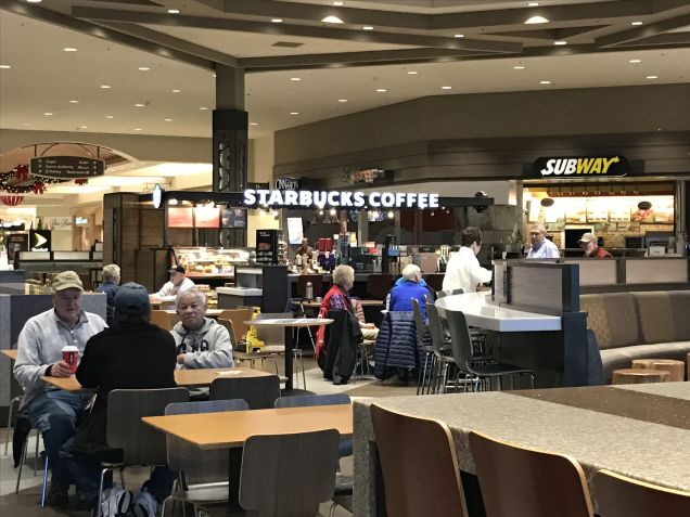
  • You don’t need to bundle up. The mall turns the lights and heat up at 8:00 a.m. because the big stores, such as Target, Kohl’s, and Macy’s, open then. During non-holiday hours, lights and heat probably go up at 9 a.m.
  • After my walk on my first day, I went to Macy’s (Yes Lisa, my Macy’s guru, I thought of you!) and did a little shopping before it got busy.
  • This could be a great way to entice teenagers to walk with you. First a walk, then a shop!
  • This is the ultimate window shopping experience. I was told once that modern malls are the equivalent of ancient shopping bazaars with their textiles, food vendors, jewelry, etc. and it’s so true!
  • There are bathrooms and water all along the way. Never a bad thing.
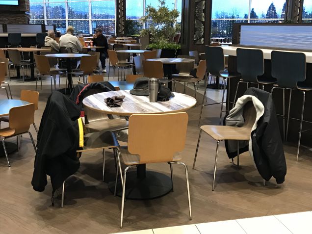
  • One seasoned walker told me that “one full lap, without cutting corners, and twice around the food court,” was one mile. I would agree. I did four laps minus the “twice around the food court,” in just over an hour.
  • Here’s a very informative booklet on the benefits of mall walking published by the CDC and University of Washington: Guide to Mall Walking
  • Mall walking is a good use of this huge, vacant, indoor space and it’s far more interesting than walking on a track.

Mall walking is a definite alternative to walking in severe weather. It’s a good “go-to” walking venue when the winds are strong. I’ll probably continue to walk primarily in nature, but it’s fun to mix it up and experience another community that promotes walking. See you at the mall!

~Ann


The Winter Wonderland Walk

For the past 9 or 10 days, the Pacific Northwest has experienced snow and freezing temperatures. The low temperatures have kept the snowy earth covered with a blanket of white, a gift that we seldom receive anymore. This was the first significant snow in town in a few years. It is always magical. The schools close, people ride the buses, families play together in the park, snowmen appear, and the world becomes a quieter and slower place, mirroring the sleep of nature. Perhaps the snowfall is a gentle nudge from Mother Nature, encouraging us to follow her lead.

winter spiral
winter spiral
Another walker in the park...
Another walker in the park ( :

This walk was taken around my neighborhood and in Whatcom Falls Park. I really just want to share some videos and pictures of my walks in the snow. I hope you enjoy them!

I hope this video doesn’t make you dizzy!

Whatcom Falls, Upper Bridge
Whatcom Falls Park, Upper Bridge
Derby Pond, Whatcom Falls Park
Snowy trees
Snowy trees
Snowy path
Snowy path

I’m always amazed that this park is two blocks from my house! What a treasure.

Ann in the snow
Ann out for a walk in the snow, with Aaron, of course
Snow patterns on our patio

These swans appeared on the pond. We think the cold temps grounded them for a bit. They didn’t like us getting too close.

Swans
Swans

We awoke to rain and wind this morning with temperatures soaring to 43 degrees from a low of somewhere around 16. The snow is gone and green blankets the earth once again…at least for now!

Happy Solstice! Happy New Year!

Ann


The Connelly Creek Nature Area Walk

Connelly Creek Trail near Sehome Village
Connelly Creek Trail near Sehome Village, Bellingham, Washington

We took this walk about three or four weeks ago, during that one week every fall when the turning leaves reach the height of color and seem to vibrate with the intensity of a hot summer sun. At every turn, we were met with another shade of gold or red, providing a visual memory of warmer days in the midst of crisp autumnal air, an interesting juxtaposition to summer’s warmth and cooling green.

Fall Leaves
Fall Leaves

Since we live near Whatcom Falls Park, most of our walks, as this one did, begin there. We set out to walk to Fairhaven via a favorite back road route we have cobbled together over several hit-and-miss walks. From Fairhaven, we walk back to downtown Bellingham and either walk or take a WTA bus home (up the hill). The walk to downtown is about 11 miles and to back Whatcom Falls Park is about 14 or 15 miles. Either way, it’s an all-day excursion. Our route takes us over Bellingham’s southern foothills just east of I-5, through the Puget neighborhood, and drops us down into the Sehome Shopping Center area. This is where we happily discovered an entirely new constellation of interconnected trails called the Connelly Creek Trail and Nature Area. We caught the trail by climbing the stairs on the west end of Adams Street, one block south of the Ferry Avenue trail head. https://www.cob.org/documents/parks/parks-trails/trail-guide/connelly_creek.pdf

Initially the trail threads its way through a thin area sandwiched between apartments and condominiums before emerging into the green open fields of the iconic Joe’s Garden produce farm. This was a real treat. We stood for a long time just looking.

img_2873

Aaron, coming into Joe's Garden area on Connelly Creek Trail
Aaron, coming into Joe’s Garden area on Connelly Creek Trail
Wintering fields at Joe's Garden, Bellingham, WA
Wintering fields at Joe’s Garden, Bellingham, WA

The trail crosses Taylor Avenue at Joe’s Garden and enters the larger Connelly Creek Nature Area. Here, you cross the creek many times. Numerous bridges give you glimpses of the creek along the way. There are many trail crossings and spurs leading into the neighborhoods of Happy Valley. The trail is well marked.

Bridge over Connelly Creek
Connelly Creek
Connelly Creek
Trail Markers ~ Connelly Creek Trail
Connelly Creek Trail

We followed the trail to Old Fairhaven Parkway and jumped on the Interurban Trail at the corner of Old Fairhaven Parkway and 24th Street. This section of the Interurban follows Padden Creek and provides access to Fairhaven Park. It eventually ends in the heart of Fairhaven with its many restaurants and cafes offering rewarding refreshments for the famished walker! Walking south (the other way) on the Interurban takes takes the walker all the way to Larabee State Park. From Fairhaven, it’s about 17 miles round trip. We’ve done it once and hope to do it again soon.

Interurban Trail History
Interurban Trail Welcome Sign
History of Interurban Trail
Going under 12 Street Bridge, Fairhaven
Walking under 12th Street Bridge, Fairhaven

The walk from Fairhaven to Bellingham along the South Bay Trail is a favorite for obvious reasons. It can lift any mood.

Bellingham Bay ~ South Bay Trail at Taylor Avenue
Bellingham Bay ~ South Bay Trail Head at Taylor Avenue

Discovering Connelly Creek Trail and Nature Area has only added to our appreciation for the value Bellingham and its residents place on creating and maintaining an interconnected system of trails. The urban walker is truly fortunate. We look forward to our next trail discovery!

Happy Walking!

Ann


The Birch Bay Walk

Getting away without getting away…

These warm September and October weekends are perfect for a walk along Birch Bay, a small protected, shallow bay located just north of Bellingham. Aaron and I often think of Birch Bay when we want to feel like we’ve gotten away without getting away. We take our Westy, a picnic lunch, a good book or a deck of cards, and make a day of walking and relaxing in this warm, walker-friendly community. We estimate our walk on this day at about 6 or 7 miles. We parked our van just across the street from the Birch Bay Visitor’s Center and walked south, through the town of Birch Bay and on to Birch Bay State Park, where we turned around and walked back. Going in this direction, we were walking against the wind, or uphill, first and with the wind, or downhill, on the way back. We appreciate doing the work first.

Our 87 VW Westfalia with Birch Bay behind

During the first few miles, the bay is on the right and summer homes, condominiums, and restaurants line the left side of the road. You can access the shore all along the way in this stretch.

A place to pause in Birch Bay
boats on Birch Bay
boats on Birch Bay
Condominiums on Birch Bay
Small stream flowing into Birch Bay
Restaurant at Birch Bay

Just after the restaurant/condominium stretch and before you get to Birch Bay State Park, there is a section where houses, small motor inns, and condominiums line both sides of the road. I had the thought that I wouldn’t see the bay again until we reached the state park. I was delighted to discover that about every 6 – 9 houses was a public access to the rocky beach.

Public Access to Birch Bay
And another!
And another!

Birch Bay State Park is a wide open area dotted with picnic tables and fire rings. Parking passes are required to park here. Many groups were out enjoying the sun and surf.

bbsp

I’ve seen so many rose hips on our walks this fall. I think it’s a good year for them. They line a section of the road in the park.

Rose Hips at Birch Bay

On our way back to our van, we saw volunteers scouring the beach for trash. Cool.

Volunteers at Birch Bay

The drive to Birch Bay is about 40 minutes from Bellingham. The warm temperatures, fresh salty air, and relaxed community atmosphere make this walk a perfect autumn day trip.

All the Best,

Ann


The Park Butte Day Hike

Aaron and I hiked to Park Butte Look Out last weekend. This is a busy place! At 10am, we pull into the very last spot in the large parking lot and consider ourselves lucky. After all the parking spots have been filled, hikers park on both sides of Forest Service Road 13 for quite a way, perhaps 1/4 mile. Our rough estimate is that about 75 cars parked at the trailhead on this sunny and warm Saturday in August. Most groups of hikers were two or more. Add to that a Washington Trails Association workparty at the look out and a pack train of mules and horses transporting supplies to another workparty, and one can easily imagine the constant hum of foot traffic on the trail. Imagine also, every hiker with a bright smile, rosy cheeks, moist brow, and lungs full of autumn-tinged alpine air and you have imagined a perfect day for hiking on the southern slopes of Mount Baker in the north Cascades of Washington State.

The first section of the trail winds its way through Schrieber Meadows, which was bursting with ripe mountain blueberries. We found out that it is very difficult to walk and pick blueberries at the same time! In this area, much of the trail is elevated on wooden walkways to protect the sensitive meadows beneath.

Schrieber's Meadow
Schrieber’s Meadow

The Washington Trails Association maintains a ladder bridge across Rocky Creek. The creek is the color of milk chocolate from the sediment it carries on its way to Baker Lake.

Rocky Creek and ladder bridge

Did you know that a female mule is called a molly? That’s what the leader of this back country pack train told me. They were bringing supplies to a trail crew up ahead. I didn’t catch his name, but his molly’s name was Emily and she was lovely.

Emily, the molly leading the pack train
Backcountry packtrain at Morovitz Meadow

The elevation gain from the parking lot to the look out is 22oo feet in about 3 3/4 miles. The last push to the look out is pretty steep and a little eerie if heights aren’t your thing. The 360 degree views are fabulous. You can sleep in the look out on a ‘first come, first serve’ basis. The work crew, who were painting the look out, trumped hopeful backpackers the day we were there. But there were plenty of other camp sites nearby; either at Cathedral Camp or at a small tarn, where I went swimming.

Park Butte Look Out from below
Park Butte Look Out with Mount Baker (and us!)

After descending from the Look Out, we walked over to a small unnamed tarn, had lunch, washed off trail-dusty legs, soaked feet, and I took a refreshing dip!

Washing off the dust
Washing off the trail dust
Small tarn in saddle under Park Butte Look Out

This is Cathedral Camp where backpackers can find many campsites and a pit toilet. Unfortunately, there is no water nearby. The above tarn is the closest water source. There were many tents there when we started down at 4pm and backpackers were still arriving! Bring your earplugs if you plan to camp here!

Cathedral Camp from above

This was a stunningly beautiful hike. Between the mountains, wildflowers, blueberries, sunshine, tarn, and pleasant company, the only thing we were missing was our overnight backpacking gear.

Happy Walking!

Ann


The Erie Canal Walk – Day Twenty-Six ~ Amherst to Buffalo

I mistakenly said, in my last post, that we had walked to North Tonawanda when we actually walked to Amherst. In the city, it’s difficult to discern where one city ends and another begins.

I’m writing this a few days after Day 26 and our arrival at the waterfront in downtown Buffalo. This eastern terminus of the trail is located in an area called Canalside.

Canalside in Buffalo, NY

This was the longest and most challenging stretch of the walk. We walked about 22 miles. The trail in Amherst and Tonawanda meandered through parks and affluent neighborhoods but eventually led us next to oil refineries, under and along freeways, next to the city of Buffalo’s sewage treatment plant and crumbling (yes, crumbling) brick factories of old. The trail was maze-like as it wound its way towards Buffalo. At one point we came to a locked gate with a sign that said this section of the trail was only open Monday – Friday. We were there on Saturday. It gave a street to use instead. We also had a long detour at one point.

Walking beneath huge blue freeway bridges which go to Grand Island

It was close to 6pm when we reached Buffalo, hot, tired, thirsty, and just pooped. The streets were mobbed with people as it was Buffalo’s annual “Rib Fest.” The festive feeling in the air was rejuvenating and just what we needed

Coming into Buffalo. The sign is on the freeway next to us.
Finishing our Erie Canal walk in Buffalo, NY

Thank you for your encouragement and well wishes sent along the way. This was a challenging endeavor and we were, many times, carried along by your words and reflections.

In gratitude,

Ann and Aaron

Niagara Falls, NY
Niagara Falls, NY


The Erie Canal Walk – Day Twenty-Five ~ Lockport to Amherst

Headstones in pioneer cemetery, Lockport, NY

We had to walk a mile and one half to rejoin the Erie Canal trail this morning. Our route took us immediately from the busy road our motel was on to a country road lined with fields of bush beans and a horse ranch. Traffic was light and it wasn’t long before we came upon a pioneer cemetary. It was not marked by a sign indictating its name, nor was there an access road to it. There was no where to park. Although many of the stones were toppled or broken, some were standing, with names and dates readable. Most of the dates indicated that the deceased had been born in the early 1800’s and lived till the late 1800’s. The cemetary is mowed by someone and a quick Google search called it the Calvary Cemetary, owned by the Roma Catholic Church of Lockport and set to be restored. The first Erie Canal opened in 1825 making many of the folks in this cemetary first generation canal residents.

Cemetery, Summit Road, Lockport, NY

This amazing stone house was very near the cemetary and is where the horses lived.

Stone House, Summit Road, Lockport, NY

The trail towards Tonawanda/Buffalo begins with rural farming residences, changing to rural residences, giving way to to suburban neighborhoods, with four lane boulevards lined with Home Depots and Rite Aids swallowing it all. We are staying on the latter. Urban Trail Trivia: the number one piece of litter is discarded cigarette cartons.

Erie Canal signature fence

This is a picture of the trail early this morning. The official fence along the Erie Canal Trail is constructed as seen above. I’ve contemplated the reason behind the design for many, many miles now. These are my conclusions, in order from the least likely to most likely. Initially, I thought they had forgotten to put in the third rung, then I came to a more meaningful conclusion. The open space, where the ‘missing’ rung is, represents the canal and the rung just above it represents the towpath where mules and horses pulled the boats and barges. A more practical reason for its design is that it makes the trail identifiable if one is not sure where they are…this happened for us today when we weren’t sure which way to go; we saw the fence and knew the correct way to go. The last rationale is purely economical. The canal system would save 25% on the cost of the fence runners by leaving one off.

Here are a few other things we saw today.

Mileage sign
Mileage sign
Uncle G's ice cream stand
Uncle G’s ice cream stand
The cutest footprints in the world! What made them?!
Freeway underpass; I hope the artist is in art school!
Wendelville Fire Department in 1862 school house

We experienced a slight feeling of melancholia today knowing that after tomorrow we would be saying goodbye to the canal and trail that have been our home for the last month. The trail has provided a consistent way forward, strewn with a variety challenging challenges, meant to exercise our commitment and endurance, as well as many open, generous, and heartfelt human exchanges, meant to strengthen our belief and trust in the goodness of the human community. We are also ready to be finished and look forward to returning to Bellingham. I will likely post a few times after we finish. I will take no offense if anyone wishes to unsubscribe from receiving this blog after The Erie Canal Walk concludes. My future posts will likely be focused on walks closer to home.

With many blessings,

Ann Continue reading

The Erie Canal Walk – Day Twenty-Four ~ Medina to Lockport

Yesterday continued…

I forgot a couple tidbits I had intended to include yesterday. We thought this was an interesting moment. At this spot, we are very close to Lake Ontario, maybe 8 to 10 miles. Neither of us have seen Lake Ontario but hope to next week. You can really see the absolute lack of shade in this section. In a word: brutal.

Sign says it all...
Sign says it all…

We read this on the lift bridge in Holley. We are guessing that the lift bridges are more than 100 years old. How cool , right!?

Holley Lift Bridge plaque

Today…

We walked about 18 miles today. It was long, hot, and muggy but we made good time, arriving in Lockport around 2pm.

Long day...
Long day…

We saw more apples today and this smoke stack, which must been at Lake Ontario. It was SO tall.

Apples in Northwest NY State
Smoke stack at Lake Ontario
Smoke stack at Lake Ontario; typical farm in Upstate NY

Lockport is home to the “flight of five,” which refers to the series of five side by side locks built to climb the Niagara Escarpment, a 70 foot high cliff of sedimentary rock. The double locks enabled boats going opposite directions to keep moving. They remind me of escalators. The city has restored one side of the original locks while the other was enlarged to accommodate modern watercraft. Here’s a little information.

Early locks at Lockport, NY
A little info...
A little info…
Another buoy boat...so cute!
Another buoy boat…so cute!
Base of locks at Lockport

This video is a little grainy but give an idea of the sound and sites.

Error
This video doesn’t exist

I’m so glad tonight is the last night of the DNC. Since we are on the east coast, we are watching in real time. President Obama began speaking around 10pm our time. We are staying up way too late to watch, but who wouldn’t want to watch our beloved president give his final address to our nation?

With love,

Ann

The Erie Canal Walk – Day Twenty-Two ~ Holley to Albion and Day Twenty-Three ~ Albion to Medina

Still smiling and getting younger!

Holley to Albion…

Our day off in Holley was restful even with the heavy rain that began early in the morning and persisted, on and off, well into the afternoon. Our tent, the Big Agnes Copper Spur 2 ultralight, is performing beautifully. Upstate New York is proving to be an excellent testing ground for tent performance. I was dry and cozy, reading away, while the thunder growled and roared overhead with the rain pouring down. New York rain storms can come and go, suddenly and fiercely, like a shower being turned on and off. We’re getting better at reading the sky and preparing accordingly. Here’s a picture of the dramatic stormy sky.

Thunderstorm clouds
Thunderstorm clouds

The stretch between Rochester and Buffalo has become quite agricultural with the leading crops being corn, apples, and cabbages. We have also seen tomatoes and what I believe were eggplant. Fields of food stretch as far as the eye can see, filling us with gratitude for the farmers of the world. As we walked this morning, we reflected on the farmers of upstate New York who, at least for our west coast experience, have been eclipsed by the celebrity of New York City, a city which owes its fame and success to the ancestors of these very farmers and canal laborers. We are learning that there is so much more to New York than the Big Apple.

Never pass up free ice water! AKA "trail magic"
Never pass up free ice water! AKA “trail magic”
Tomato field in Upstate NY. Note the meticulous staking of the plants
Apple Orchard
Apple Orchard
The light green through the trees is cabbage
The light green through the trees is a cabbage field

Albion to Medina…

We left Albion 6:55am to beat the heat. There isn’t any shade over the trail anymore. We are glad we are walking west with the morning sun at our backs. I don’t think I’ve mentioned the constant headwind that we are walking against. We are appreciative of it as it provides much needed ‘convected coolness.’ We stayed about a mile from the trail last night and on our way back to the trail this morning we walked right pass a NY State correctional facility in Albion. All I can say is that it was a sight to see.

We have seen a bit of wildlife in the last few days, including a fox, a groundhog (the canal’s enemy…think holes), several river otters, a tree FULL of turkey vultures (I counted 15 from across the canal), and a snapping turtle who wouldn’t come out of his/her shell, no matter how nicely Aaron asked or how gently I nudged it with my walking stick.

Shy snapping turtle
Shy snapping turtle

Medina (pronounced with a long “i”) is famous for its apples, sandstone, and the Robert H. Newell shirt manufacturing company. In the early days of the canal, Medina apples were shipped as far as Africa. Barrel makers, from nearby Knowlesville, called ‘coopers,’ crafted the finest barrels from oak and metal. This is a picture of the Medina harbor covered with barrels of apples awaiting shipment down the Erie Canal to NYC and onto ships bound for distant continents.

Medina apples bound for ports around the globe

Medina sandstone became the building material of choice during the growth of towns along the canal. We read that there were many sandstone quarries in this area. The stone proved strong and abundant. On our stroll around Medina this afternoon, we measured sidewalk pavers measuring 7 x 11 of my feet. So the sidewalks were/are sandstone and all the curbs are granite. Here is St. Mary’s Church made of Medina sandstone. It is utterly magnificent. Medina sandstone is also found along the trail under bridges.

The steeple of St. Mary's rises above the town. We always saw the steeples first.
The steeple of St. Mary’s rises above the town. We always see the steeples first when coming into a town.
St. Mary's built out of Medina Sandstone
St. Mary’s built out of Medina Sandstone
The front of St. Mary's, Medina, NY
The front of St. Mary’s, Medina, NY

Robert Newell made shirts in Medina for celebrities such as Bob Hope and Winston Churchill. His factory is now home to the Hart House Hotel and we are staying here tonight!

Robert H. Newell shirt factory building, now a boutique hotel

We have three days of walking to finish this walk. Our next stops will be Lockport, Tonawanda, and Buffalo. We are ahead of schedule, which gives us a little time to explore the greater Niagara Falls/Lake Ontario area. We have decided to rent a car in Buffalo, camp near Lake Ontario for a few days, and take day trips to see the sites! We’re very excited to be finishing!

All the Best,

Ann


The Erie Canal Walk – Days Twenty and Twenty-One ~ Adams Basin to Holley

Sunday…

After a leisurely morning at Adams Basin Inn, we walked about eleven miles to the tiny village of Holley where there are campsites for boaters, bikers, and hikers. We will stay here two nights, taking a rest day. We are camped right next to another lift bridge! I’m sure one grows used to the wonder of watching the whole bridge lift, but not us. We are still captivated by them. We had a long conversation with Jane, the lift bridge operator about the history and operation of the lift bridges.

Massive Tree at Holley, NY. The house below is two-story and the tree just towers above it.

She explained that the bridges were built a long time ago and were not constructed for amount and kinds of traffic they are serving now. Heavy trucks, loaded with gravel or stopped traffic on the bridge, are taxing the bridges beyond their abilities. Increased boat travel has the bridge going up and down more frequently and operators, pressured to get to get car traffic moving, raise and lower the bridge too fast, basically slamming it down into its fittings. The bridges are so charming to tourists but impact the lives of locals. Coming through Brockport yesterday, where there are two lift bridges, one of them was not working. Car traffic was stopped intermittently and boat travel was just stopped. They couldn’t raise the bridge. When we got to Holley, there were boats waiting for the bridge to open.

Monday…

We woke to big thunder and lightening and rain. We put all our gear in the tent, put on rain gear, buttoned down the hatches, and headed for the local diner for breakfast. Well-needed rain is expected all day so we will likely be in the diner for a while. ( :

Operator's tower at the lift bridge in Holley, NY
Operator’s tower at the lift bridge in Holley, NY
Tender the Tug at Holley, NY

Here’s a short video of the Holley harbor. The orange and white tent is ours. Aaron is filming from a gazebo and I am warm and dry in the tent, reading and listening to the rain fall.

Waiting for the sun,

Ann