This post is a long time coming and I apologize for my gap in writing. Since my last post in May 2019, Aaron and I have sold our home of 18 years in Bellingham, Washington, along with the majority of our possessions, and moved to the small mountain town of Sandpoint located in the panhandle of Northern Idaho. We lived in Sandpoint before we moved to Bellingham and have always kept in touch with the area. We ride our bikes or walk just about everywhere. We can go for days without getting in the car. Our love of walking definitely contributed to making such a drastic change at this time of life. The move hasn’t been without its share of bumps but overall we are well and happy with our decision. We are renting a 750 sf condo on the banks of Sand Creek, three blocks from the town center. It’s a really small space and we love it! Here is the summer view from our tiny patio!
Our daily view! Our condo comes with a boat slip. Now all we need is a boat! We did use an abandoned canoe that we cleaned up and paddled up and down Sand Creek, which flows into the lake.
But enough about us…here is the hike!
Aaron and I hiked this trail twice, once at the end of July and then again in the beginning of August. It’s not a terribly long hike but it is definitely rigorous. Its one-way distance is a mere 3.5 miles but it climbs a total of 2150 feet making it a hike you definitely don’t want to be starting at 10am on a 90º North Idaho summer morning. We know this for a fact because that’s just what we did! All the way to the top I vowed I would never do this hike again…that was until we entered a lush shady dell and were surrounded by a multitude of low growing shrubs covered with hundreds of coveted huckleberries! I had brought one empty pint container on the off chance that we might see some. Little did I know that we would discover the mother lode! We continued on to the top, ate our lunch on the memorial bench while basking in the spectacular view of Sandpoint, Idaho and Lake Pend Oreille. The trail head is very close to town. We can ride our bikes to the trail head, hike, then ride home. Easy Peasy!
Hundreds of Huckleberries on the Mickinnick Trail. After picking our pint we decided to return the following week armed with more empty containers. We picked over 1/2 gallon on that day!
Please read this picture with the history of this trail. It’s very moving and part of what makes this trail so special.
Trail HistoryTrail Map with all the local and federal agencies that worked together to make it possible
The next set of pictures shows the unfolding of the view as the hiker climbs.
The Very Beginning. There’s a spigot right here to fill your canteen with fresh cold well water.Getting higherYarrow strewn trail…
Sandpoint and the Long Bridge going across Lake Pend OreilleAaron almost at the top!Trail’s End…look at that lake! We swam in it everyday this summer!Bench at top dedicated to Mick PleassIndian Paintbrush
Thank you for reading. Please visit us in Sandpoint. All contact info is the same except for our address, of course.
Ebey’s Landing, on the west side of Whidbey Island, Washington, (near Coupeville, Washington) is one of the last undisturbed saltwater-influenced lagoons of the Puget Sound’s coastal lowlands. Above the lagoon towers the arid bluff with its fragile plant life unique to Ebey’s and only a few other areas in the world. It is managed and protected by a number of agencies, including The Nature Conservancy. Here is a little information about that.
A little history of Ebey’s Landing on Whidbey Island, Washington
This hike has been a longtime favorite of Aaron’s and mine. In fact, we were married about a mile from this dramatic historical headland at The Jenne Farm, which is a preserved farm within the Ebey’s Landing National Historic Reserve. The ceremony was on a gorgeous day in June seventeen years ago and we all came over to the beach at Ebey’s Landing afterwards to continue celebrating and to enjoy this amazing place.
The Ebey’s Landing hike begins in the parking lot, ascends a series of steep wooden stairs to the field above, continues to climb up the bluff to a gently rolling trail along the bluff, and descends on the far end via an elaborate series of switchbacks to the beach. The hiker walks back to the parking area along the beach. We so appreciate loop trails like this one, which is 3.5 miles in total. It’s perfect for packing a picnic lunch on the beach or take the short drive into Coupeville for a steaming bowl of Penn Cove mussels after your hike. Coupeville is located right on Penn Cove, which is famous for its mussel industry. It is also just a super quaint little town. Very touristy all year long and offers a fun Musselfest in March every year andCoupeville Arts and Crafts Festival every August. Can you tell we really like it here?! ( :
Parking Lot at Ebey’s Landing with the headland in the distanceA Discover Pass is needed to park in the lot but if you turn around, you can park on the road without one! See next picture!Road parking at Ebey’s Landing…no Discover Pass required!Aaron took the pictures for this post so I got to be in some of them! Yes, I’m hiking in my Keen sandals…easy on and off for walking in the waves!Stair climb!Ascending the BluffLooking back towards trailhead…what a view!Ferry from Coupeville going to Port Townsend with Mount Ranier in the distance. We had just crossed on this ferry coming from Port Townsend on our way home from Olympia, WA and decided to stop for a hike on this absolutely glorious day!Okay, last one of us! Aaron holds the phone and I push the button. Teamwork!The bluff is super steep!Looking straight down the bluff at the beach below. You really want to stay on the trail here!Looking southwest, across Admiralty Inlet, to the snow-capped Olympic Mountains of Olympic National Park.Looking back one more time before the parking area disappears around the bend.
The next three pictures are Aaron’s artistic pictures of the beach at Ebey’s Landing. This hike is a great day trip from Bellingham or anywhere in the Puget Sound really. There are two campgrounds nearby, Fort Casey and Fort Ebey, plus numerous Inns and B&B’s in Coupeville, if you want to make a weekend of it. This is just as good as it gets!
For the last few years, Aaron and I have made it a tradition of taking a long walk over New Year’s somewhere in the San Juan Islands. Last year, we walked on tiny Shaw Island and the year before that, San Juan Island. This year we traveled to Orcas Island to walk over Turtleback Mountain, which through the efforts of the San Juan County Land Bank, the San Juan Preservation Trust, the Trust for Public Lands, and more than 2,000 private donors, is one of the largest protected natural areas in San Juan County. It is comprised of 1,718 acres of woodlands, grasslands, quiet forests, and scattered wetlands. It provides the walker with the occasional fabulous view to the north, west, and south.
From the ferry, one can see why Turtleback Mountain was named Turtleback Mountain!
We walked on the Washington State Ferry at Anacortes bound for Friday Harbor on San Juan Island, where we lodged at the Earthbox Inn for two nights. Early in the morning on our one full day, we hopped on the smaller inter-island ferry bound for Orcas Island.
Early morning ferry in Friday Harbor, WAWalking on an almost empty ferry bound for Orcas Island.
Turtleback Mountain has two trailheads; a northern and a southern. Since we were on foot, we decided to take a taxi to the northern trailhead, through-hike to the southern trailhead, and walk back to the ferry from there. I had arranged with Eric from the Orcas Island Taxi to meet us at the ferry and drive us the 5.7 miles to our starting point. He was waiting and knew exactly where to go! Eric told us he had a big night ahead…since it was New Year’s, he would be offering free rides home to folks between the hours of 12 midnight and 2 a.m…pretty sweet of him.
The trail immediately climbs and doesn’t stop until the highest point on the Raven Ridge Trail at 1519 feet. It was a crisp, clear morning and we were soon warmed through and through by the effort this trail required. We stopped at the North Valley Overlook and could see the refineries at Cherry Point near Birch Bay and the Canadian mountains beyond. We also stopped at the Waldron Overlook, which offers amazing views of Waldron Island and beyond to the west. We skipped the Turtlehead Trail due to time constraints. We had to make it back to the ferry by 4 pm and had roughly 4 additional miles of trail walking and about 5 miles of road walking back to the ferry. From the Waldron Overlook, we chose the Raven Ridge Trail, which took us to the summit and from there it was downhill all the way to the south parking lot/trailhead.
The trail is very well marked. Even so, in addition to food, water, layers, and rain gear, I would suggest bringing a map. Be prepared for a real workout. There are very few switchbacks and the trail is steep. We experienced the kind of post hike soreness that had us going down the stairs in our home backwards for a couple days, if you know what I mean. Also, the 2.5 mile section of road walking along Deer Harbor Road back to the main Orcas Road was the kind of road walking that no one should really do and I can’t recommend. There is virtually no shoulder and many blind turns. But, we made it and in the end had a wonderful day!
Turtleback Mountain Map
We arrived back at the ferry dock about two hours before our ferry. We grabbed a sandwich from the Orcas Village Store and took it to a newly opened wine bar called Champagne, Champagne. Since it was New Year’s, the owner was serving everything bubbly. We ate our sandwich with a glass of fizzy Pinot Noir, played a few hands of cribbage, and watched the sky turn to an amazing pink. The sun had long set as we arrived back in Friday Harbor.
I’ll close with a video of our day! I hope you enjoy it as much as I do!
Before I begin, please notice that I have installed a navigation widget on the sidebar of my blog where I placed all the posts from our Erie Canal Walk in chronological order. This is very exciting for a couple reasons. First, the navigation menu makes it easier for readers to read the posts in order, without all the troublesome scrolling and secondly, I figured out how to install the widget all on my own, acquiring some new terminology along the way. ( :
Also, you can always open the blog to your browser by clicking on the title. (You probably know this!) You can also open the video to full screen, which just makes me so very happy every time I watch it…about 100 times so far!
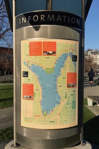
The Cheshiahud Lake Union Loop Walk
This walk is PURE JOY, especially when you walk it on a gloriously beautiful day as we did a couple days before Thanksgiving this year. We were going to Seattle to see David Sedaris at Beneroya Hall and decided to take an extra day to do this walk…again. We had walked it a year earlier and I was hoping to return in order to share it with you.
Since the walk is a loop, you can hop on at any point but I believe beginning at Lake Union Park at the southern tip of Lake Union, where you’ll find the Museum of History and Industry, is the perfect ‘putting in’ spot. From there, you can see the entire lake laid out before you and attain a sense of where you will be going. We were staying downtown with about a 20 minute walk to the lake. We walked in a clockwise direction and, for the most part, paralleled Westlake, Northlake, and then Eastlake Boulevards as we circumnavigated the lake.
The loop is 6 miles around. You can pack a lunch or grab some on the route. At about 2 miles, if traveling clockwise, the trail takes you right through the Fremont neighborhood, which has numerous restaurants including the Fremont Brewery, a PCC (Puget Community Coop), Starbucks, etc. You will cross the historic Fremont Draw Bridge (it went up right after we crossed!) and the University Bridge. You will go under the Hiway 99 and I-5 Bridges. The trail connects numerous neighborhoods and parks, some huge and rolling like Gasworks Park and some tiny and unassuming, no bigger than my living room…these are very special and a testament to why Lake Union is affectionately referred to as “A Lake at the Heart of a City.” The lake slightly resembles a heart…
Map of trail at Lake Union ParkClose up of where we began the walkSign at Lake Union Park
Before I end and leave you with an awesome video collage of our walk, I have one piece of advice: you must be diligent in looking for the trail signs, especially once you get to Fremont on the north and then coming down the eastern shore of the lake. There is so much to see on this urban walk that one could easily miss a sign. The upside is that if you just keep the lake on your right (or left if you’re traveling anticlockwise), you’ll be fine. Download map here!
This post is a long time coming! Of course, there are many reasons for such a long interval between posts…a busy year, life transitions, etc. And while all of that is true, it really just comes back to an undercurrent of Fear that I’ve recently began to observe in myself. I’m pretty sure its been there all along, slinking along the sheltered recesses of consciousness, out of sight, out of mind, adding its commentary to the ongoing narrative, and ultimately having an influence on decisions and outcomes. “Surely no one wants to hear about the Chanterelle Trail (or anything else for that matter),” Fear whispered to the Walk Blogger.
This past summer, I transitioned from a busy 24/7 teaching position to a part-time shop girl job. Talk about Fear! But the image of unloading a mountain of responsibility for a simple, quiet, inward year of self-reflection and artistic exploration could not, would not, be dampened by Fear’s insidious methods. This professional “pause” is my 60th birthday gift to myself and what I’ve come to realize is that the real gift has been the space to reestablish a relationship to time, that construct that maintains order in our lives…sometimes at a cost.
Don’t get me wrong though. I have been a fast-pace junkie. I perform better, think better, and possibly feel better when cramming 30 hours into 24. You too?! Lucky for me, my teaching position provided an organic moment to come up for air and upon reaching the surface, I wasn’t just breathing, I was gulping.
So where does Fear fit into this narrative (or the Chanterelle Trail, for that matter)? I’ll get to that, I promise.
One of the benefits of increased “free time” is the opportunity to observe and reflect on oneself. Through this reflection, I have become aware of the ways in which Fear weaves itself into every day life. Some Fear is healthy Fear. “You should not walk alone on that trail under the freeway where the man was stabbed last month.” Thank you Fear. Duly noted. I wholeheartedly agree.
On the other hand, the Fear that no one would want to read a blog about The Chanterelle Trail, and possibly more accurately, one written by yours truly, is simply rubbish. So, after that long introduction, it was our first go at hiking The Chanterelle Trail that brought into clear focus the presence and effect of Fear.
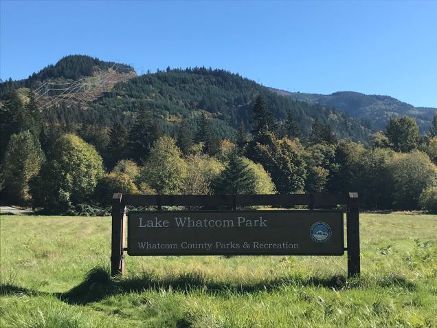
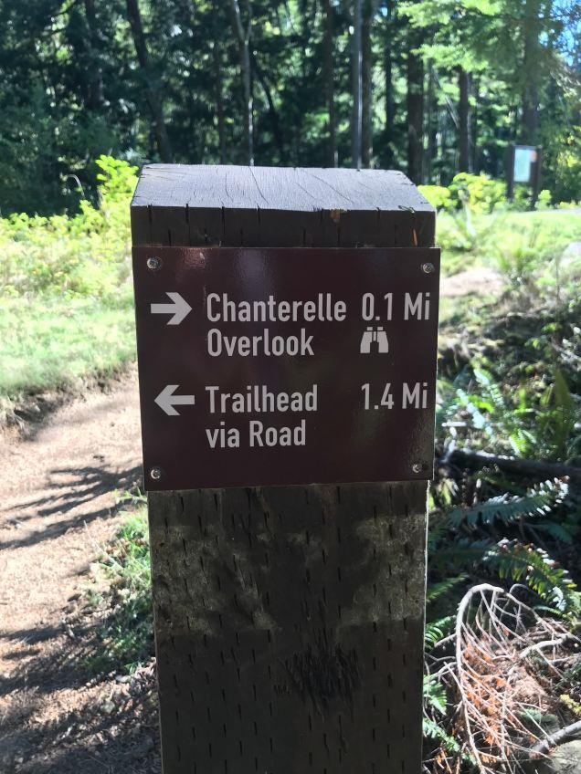
One very rainy day, about a month ago, Aaron and I decided on a spontaneous hike up the 2.4 mile Chanterelle Trail, in Whatcom County’s Lake Whatcom Park. We donned full rain gear and set out at about three in the afternoon. For some reason, we did not expect a fairly rigorous ascent in the wilderness. I think the word “Park” fooled us into believing that this would be akin to walking in Whatcom Falls Park or similar. Anyway, as this was a spontaneous walk through a “park,” we totally abandoned all the rules of setting out into the rainy wilderness late in the day and didn’t bring water, snacks, headlamps, or first aide. Nothing.
The Chanterelle Trail ascends fairly dramatically for the first quarter mile or so and then levels off to a more gradual ascent for the remainder of the hike to the lookout and turn around point. As we ascended on this rainy day, the deep dark woods slowly became deeper and darker. The sound of the wind rustling the leaves was amplified by the cover of clouds, which hung in the trees creating an eerie landscape of limited visibility and unsettling noises. Needless to say, Fear was having a heyday with my imagination and before long, I was convinced the woods were full of bears and/or cougars. In my defense, there have been many sightings of bears and cougars in the area and knowing this did not help. I was sure that with every step forward, the odds of encountering a large carnivore became greater and greater. We were about 1/2 mile from the lookout when up ahead came a loud crashing noise through the forest. Well, that’s all it took. I turned around and ran down the trail…so fast in fact that I couldn’t hear Aaron calling to me that a large branch had broken and fallen, making the crashing sound. It wouldn’t have mattered anyway. I was so hijacked with Fear that the only antidote at that point was the comfort of knowing we were heading towards the safety of the truck and home. On the ride home, we decided we would return on a sunny morning with water and snacks, which we did about three weeks later!
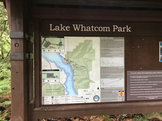
Rainy day at The Chanterelle Trail trailhead
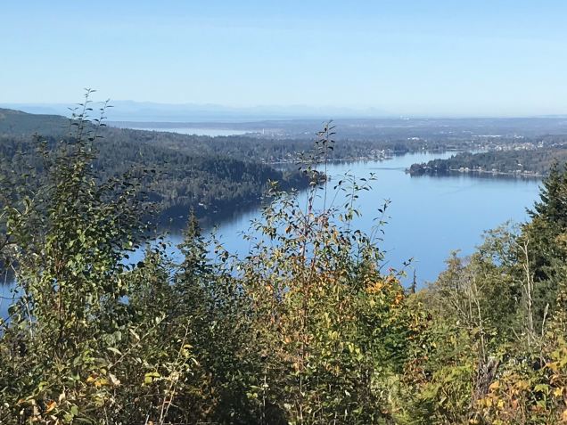
The Chanterelle Trail is a great hike for getting the heart and lungs pumping and offers an amazing view of Lake Whatcom, Bellingham Bay, and the San Juan Islands. It is 4.8 miles round trip, with 1000 feet of elevation gain to the lookout point. When we returned, the leaves were half off the trees, allowing for peek-a-boo views of Lake Whatcom.
Sign and map in parking lotwalking from lower parking lot to upper lot where trail begins (already busy in the morning!)Rules of the TrailChanterelle Trail crossing Wickersham Roadlush forests line the switchbackssmall bridge over streampeak-a-boo view of Lake Whatcom on our ascentAlmost there!View looking west over Lake Whatcom to Bellingham Bay and Orcas Island in the distance!Looking south over Lake WhatcomAaron’s panorama of both previous photos with Lookout Mountain directly across lake.
Our second hike was successful! We sat at the top for a while, eating our bananas, drinking our water, soaking in the stunning views without a trace of the Fear that so punctuated our last attempt. I’ve thought about that Fearful day many times since then. There may have been a bear or cougar nearby. My Fear may have been spot on. I’ll never know. But what I do know is that all one has to do is turn on the TV or radio or open the newspaper to totally justify a heightened sense a Fear in our lives. I had just begun to write this post earlier in the week before going to a yoga class with Amy at 3 Oms Yoga in Bellingham. It was election day and Amy talked about Fear in her opening words, which was incredible given that I had just been writing, quite candidly, about my experience with Fear. One thing she said resonated with me and helped me bring balance to this experience. She said, and I paraphrase, Fear does not define us. It is not who we are. It is an experience we are having and because we can look it at it objectively, talk to it, and ask it questions, we are able to discover what Fear is trying to tell us about ourselves and the world. Somewhere I knew this but it was good to have it offered in this way. Amy’s words brought normalcy and a sense of wholeness and unity to the experience. I was no longer alone in my Fear.
If you’ve read to here, thank you! I usually don’t share such personal reflections and thoughts in my posts. I wonder what insights our next walk will offer! Stay tuned!
This is the second of two walks we took over New Year’s 2017 in the San Juan Islands. The first was The Shaw Island Walk from our previous post.
Surprisingly, this sign is only posted at American Camp, not in town where the walk begins. It would be helpful if it was posted at the trail head in town.
Overview…
This round-trip walk begins and ends in Friday Harbor, Washington on San Juan Island. The map for the walk says that the mileage is 6 miles to the American Camp Visitor’s Center. We have walked it twice now and believe that it’s more like 7 + miles one way, making it 14 or 15 miles round trip. Additional miles and time are added if you hike on any of the trails in this National Park Service Historic Park, which you really must do. So, prepare for an “all-dayer.” Pack a lunch, snacks, plenty of water, warm layers, and of course, rain gear. We lucked out on both trips here and didn’t need it. It can also be a help against the winds at the southern tip of the island, which is a peninsula of sorts and exposed to the elements on all sides. The trail offers amazing views of Griffin Bay and Mount Baker at many points along the way. Walkers will also enjoy views of the open pastoral land common on San Juan Island. Miles of additional hiking trails and views of Haro Strait, Vancouver Island, and the Olympic Mountains reward the walker’s efforts at American Camp.
Finding the trail…
This was our second time walking this trail. The first time was at New Year’s, when 2015 turned into 2016. We stumbled upon it quite by accident, not knowing there was a trail all the way to the south end of the island. Much to our delight, we have found many trails in the same way. This time we knew about the trail, of course, but also found the true beginning of the trail on Spring Street in Friday Harbor. If staying in Friday Harbor, walk up Spring Street, the main road up from the ferry, until the airport becomes visible on the south, or left, side of the street and watch for the teeny-tiny sign that indicates the trail. The signs to follow are green and about 4″ x 4″ and say “American Camp Trail.” Sometimes they are just a small green arrow. The walker must be diligent in looking for them at every crossroads, corner, or intersection. It’s a bit of a fun scavenger hunt as you look for the next clue leading you ever onward towards your destination. There is one short section (about 1/8 mile) of road walking on busy Cattle Point Road. Road walking is never fun for me, but the shoulder was wide-ish and the drivers, for the most part, gave us the space we needed to feel safe.
I would suggest getting an early start if hiking in the winter. We opted for a leisurely morning and found ourselves returning to Friday Harbor just after sunset, which is early here in the Pacific Northwest on New Year’s Eve day…somewhere around 4:15 p.m.. The late start meant we couldn’t spend as much time at American Camp as we had during our first time there.
Teeny-tiny marker for American Camp Trail just past the office supply store. Walk down that dirt road and between the warehouses. This is the beginning of the trail that one can follow all the way to American Camp.This is the second sign a few paces past the first. It’s the little green signs to watch for on this walk.Trail running behind warehouses at airportA short bit of road walking near airport. That is the back of the Friday Harbor Hospital.San Juan Island Airport is a busy place any day of the year!This is the first sign on the other side of the airport, where the trail becomes a grassy path.The trail goes through brushy wetlands south of the airport. See that little green sign? Those are the ones to watch for. This section of trail was also called the Minnie Mae Trail…Minnie Mae from Anne of Green Gables, I’m guessing?View of Griffin Bay south of Airport on Cattle Point RoadThe trail follows Cattle Point Road for quite a distance allowing for views like this one. It’s wonderful how the San Juan Island Trail Committee asked for and received permission of many land owners along the way to construct the trail on their land keeping walkers safely off the road.The trail following alongside Cattle Point Road.The trail lies on west boundary of the Frazer Homestead Preserve
The Frazer Homestead Preserve would be a nice side trip to this walk. Here’s a picture of the original farm house with Mount Baker in the background. What a view to wake up to!
Frazer Homestead Preserve with Mount Baker in the distanceLuckily, we passed these gals going both ways. The second time they were brave enough to come as far as the fence would allow to say hello. They both appeared to be pregnant…although I’m no expert on donkeys. ( : They sure were beautiful though.Cute sign…a little humor never hurts.We made it!American Camp viewThe sun is well on its way to setting behind the Olympic Mountains as we decide to head back to Friday Harbor about 7 miles away. Luckily, we had our headlamps if needed but there was still plenty of light as we arrived at town tired and hungry.
We saw no other walkers on the trail except a young trail runner close to American Camp and a man walking his dog on the Minnie Mae section. We had to wonder how many people walk from town to American Camp and hope we are not the only ones who enjoy these kinds of adventures. Admittedly, winter walking isn’t everyone’s cup of tea. I’m betting more walkers take advantage of this trail during the summertime.
Thanks for reading and as always, Happy Walking and Happy New Year!
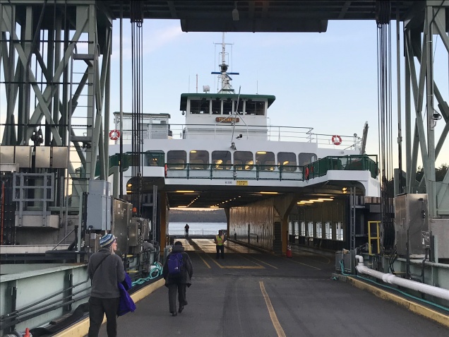
Friday Harbor ferry dock from top level of ferry just before setting sail to lovely little Shaw Island for one of two New Year’s weekend walks!!
Getting There (with this walk, getting there was half the fun!)…
This walk begins at the ferry dock on Shaw Island, Washington. You can park your car at the Anacortes Ferry Terminal for $5.00/day, buy a ticket inside, and off you go. Be sure you’re on the correct ferry as this is a busy place, with many ferries coming and going. Also, be sure you know what time you need to be back at the ferry dock on Shaw Island to catch the ferry back to Anacortes. The ferries to Shaw Island are fairly infrequent compared to the other islands, especially in the winter months. Aaron and I were staying on San Juan Island and caught the smaller inter-island ferry over to Shaw Island in the morning and back to San Juan in the afternoon, which was super fun and added to the adventure!
Early morning in Friday Harbor, WABoarding an almost empty inter-island ferry at Friday Harbor bound for Shaw Island.A couple cars loading the ferry at Friday Harbor.The unmatched sunrise beauty of the San Juan islands at New Years 2017.Orcas Island Ferry Dock. Our ferry stopped here on its way to Shaw Island.Arriving at Shaw Island. The dock has retained an original hand-carved sign over the landing.
Shaw Island…
Washington State Ferries serve four of the 172 named islands of the San Juan Islands: San Juan, Orcas, Lopez, and Shaw. Shaw Island is the baby in size and population. It has a year-round population of about 250. There is a historic general store at the ferry dock (closed for the winter), a post office, and an active community center. In a word, it is idyllic, making it the perfect venue for any walk.
The Walk…
I had a fairly good idea of where we were headed, “from the ferry dock, walk south along Blind Bay until you come to the Community Center, turn left, walk some more until you come to Shaw Island County Park, check out the beach at Indian Cove, then continue, in the same direction, to Squaw Bay, where you’ll see the trail head leading north into the Graham Preserve. Follow the trail through the Preserve back to the Community Center and walk back along Blind Bay to the ferry dock.” And that’s pretty much what we did…easy peasy. A few cars passed as we walked and we met two other walkers, who were on holiday on the island. Other than that, we pretty much had the place to ourselves. Oh, I musn’t forget the two cats at the ferry dock, who entertained and kept us company as we awaited the ferry back to Friday Harbor.
View along Blind Bay. That’s the Orcas Island ferry dock across Harney ChannelTraffic sign along Blind BayThe junction of Blind Bay Road and Squaw Bay Road at the Community CenterCommunity Center, Shaw Island, Washington
Beach at Shaw Island County Park, a rustic campground.Squaw BayA curious llama at Squaw Bay…he/she was BIG!Trailhead marker at Graham Preserve
At the terminus of the trail just behind the Community Center…we’re still trying to figure out where to look when taking selfies! ( :The warming hut at the ferry dock. It had a heater!“Open the door or else!”Our new Shaw Island friend…Shaw Island Ferry Dock and MarinaArriving back in Friday Harbor just as the BIG ferry from Victoria BC was leaving on it’s way to Anacortes
This walk could easily be made longer by continuing west on Squaw Bay Road, turning north on Hoffman Cove Road, which brings you back to Blind Bay Road. We were constrained by ferry times and actual hours of daylight, which are few at this time of year in the Pacific Northwest. We’ll save that walk for one of our long summer days perhaps.
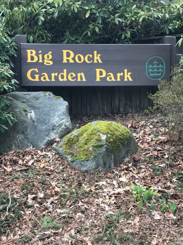
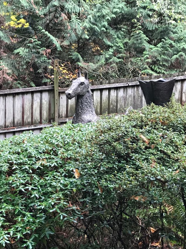
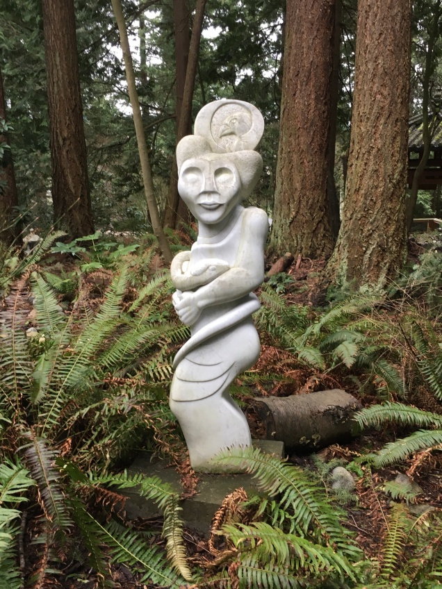
Imagine an outdoor museum with native ferns, salal, and vine maple for a floor and a glittering ceiling of sunlight twinkling through the canopy of towering cedars above. This is what makes this special park a feast for the eyes and a respite for the soul. Once you enter the park and begin winding your way through the gently rolling serpentine paths, an unmistakable mantle of peace and quiet envelops you while sculptural delights surprise you at every turn. Some are whimsical, some invite heartfelt contemplation, while others are meant to be puzzled over. Over 39 artist pieces dot this 2.5 acre haven of artistic exploration. If you’ve never been to Big Rock Garden Sculpture Park, you have a real treat awaiting you! For directions, hours, and events at the park, please see the City of Bellingham’s website here.
Entrance into Big Rock Garden Park. There is a fence around the entire park.
There is a small parking area at the park but I would suggest parking your car or taking the bus to Bloedel-Dovovan Park and walking up through the quaint Silver Beach neighborhood, into the cedar and sword fern forests of the Silver Beach Preserve, and on to Big Rock Garden Sculpture Park. The entire walk there and back is no more than 2 miles, making it great for kids or when time is limited. Once you’ve arrived at Bloedel-Donovan Park:
Walk north on Electric Avenue and cross Alabama Street.
Continue straight up the slight incline on Dakin Street about 2 blocks and turn R on Silver Beach Avenue.
Walk about 2 blocks and turn L on Peters Street.
Walk up Peters Street until you see the path directly in front of you (as if Peters Street continued but turned to path) This section is short but steep. Yay for walking workouts!
Keep following the path until you see sign for Big Rock Garden Park…it’s super easy.
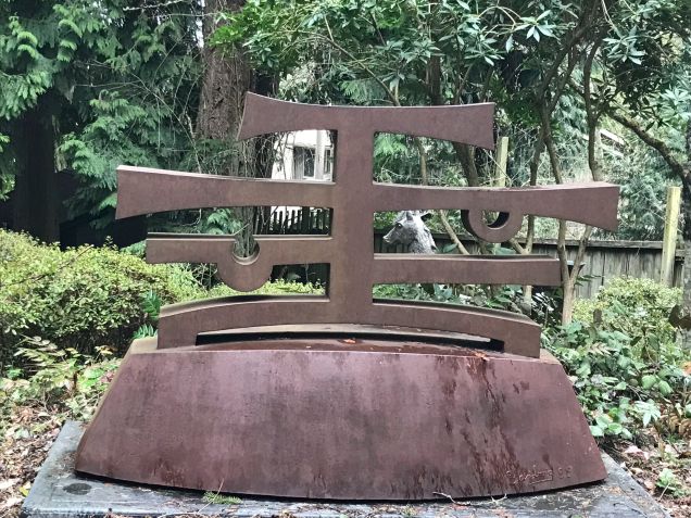
A Handful of Big Rock Garden Park’s Treasures…
Sculpture. Big Rock Garden Sculpture Park
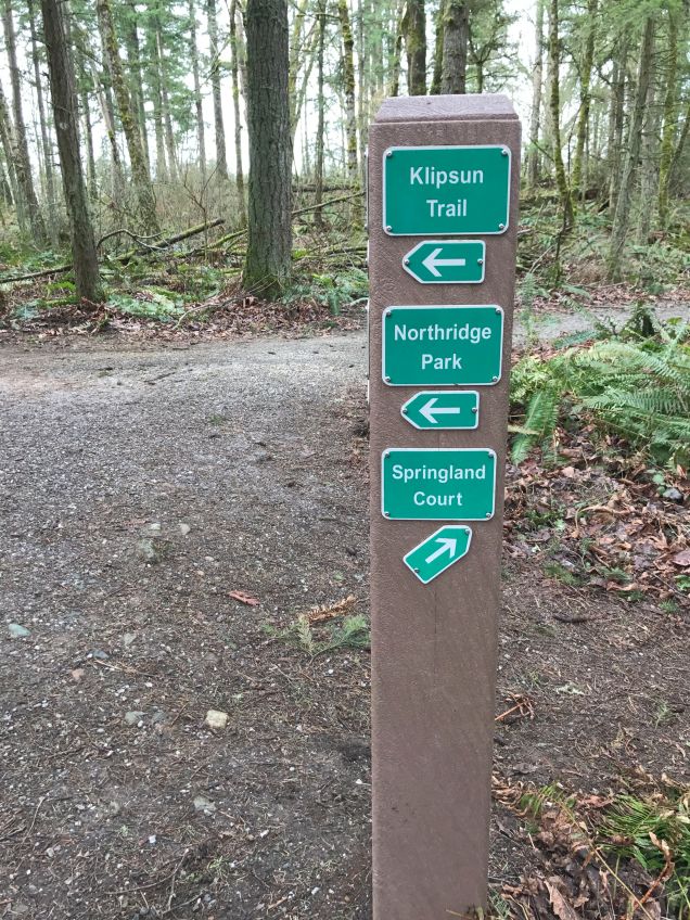
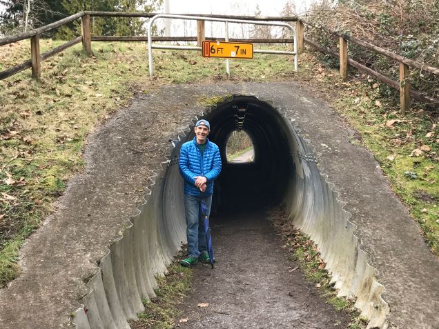
If you want to add more walking to this walk, you can follow the path back (the way you came) through the Silver Beach Preserve and follow the well-marked trail signs north to Northridge Park. This park is at the very top of Barkley Hill and the main trail makes a big loop that brings you right back to where you began. This would add roughly 2 more miles to your walk. It’s definitely worth the time and effort.
Sign to Northridge ParkThe trail goes under Barkley Avenue on its way to Northridge Park.
I hope you find your way to this special park. It is sure to surprise, delight, amaze, and possibly even inspire you!
This is my first post in quite a while. In late March, I fractured the 5th metatarsal on my left foot, resulting in a complete cessation of any walking. Four months later, I’m up to about an hour of walking every couple days and lots of yoga. That is all my physical therapist will allow. We’re looking at six months to full recovery and that’s only if I’m ‘good’ and follow his advice. It’s been a real learning experience. I’ve learned about patience, how to care for oneself, how it feels to be disabled, how society views, cares for, and accommodates the disabled, and the precious gift of health. May I never take it for granted…
Western Washington University…
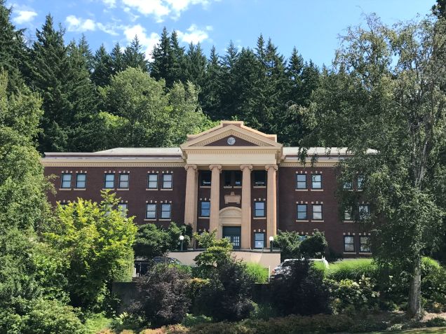
WWU, Garden Street entrance
Western Washington University began in the 1890’s as a “State Normal School,” eventually becoming a college devoted to education majors. Since then, it has become a larger learning center with degrees offered in many majors.
This was a perfect day to stroll through the hillside campus of WWU in Bellingham, Washington. It had rained in the morning leaving the air fresh and the earth well-watered. The temperature was cool but not too cool. The campus looks out over Bellingham Bay and the distant San Juan Islands. The grounds in summer are spectacular. Century old trees, fragrant rose gardens, and native plants are cared for in a manner that support the ideals of education: imagination, vision, beauty, balance, and purpose. The natural world that has been artfully created on WWU’s campus, invites the visitor and student to stand up straighter and lift their gaze to a higher potential and goal. So, in addition to the sculpture garden, there are the nature gardens too…an added treat.
The first building on the campus was the 3-story, 36-room, “Old Main.”Rose Garden to the side of Old Main.Edens Hall
The Sculpture Garden…
The sculpture garden is overseen by the Western Gallery. There are 27 sculptures on the sculpture garden map. It seems you can pick up a handy booklet about the sculptures in the Western Gallery but I used only the map and it was fine. I want to take this walk with Aaron soon so we will pick up a booklet then. Honestly, it was enjoyable just contemplating the artist’s meaning of the sculptures rather than reading the meaning. When I have the booklet, I’ll be able to see how close I came to understanding the artists’ messages.
The map uses letters of the alphabet (A to Z to AA) as a key to the location of the sculptures. For the most part, it was accurate. I expected the sculptures to be in plain sight and and most of them are. Some are more difficult to find as they are on walls, in buildings, or off the main trails, which added to the ‘discovery’ aspect of the walk. There were two that were missing (I could see where they had been) and one that I searched and searched for but never found. It was disappointing too, as it has the most interesting title, “The Islands of the Rose Apple Tree Surrounded by the Oceans of the World For You, Oh My Darling.” Who wouldn’t want to see that sculpture, right?!
Parking can be tricky at WWU. I was lucky to get a parking spot on Garden Street just below the campus. One could easily take one of the numerous public buses that go up to WWU from downtown too. After parking, I walked up (and I mean up) to Red Square, the heart of the campus, where exhibit A was waiting. I followed the ‘alphabet’ on the map, making it a scavenger hunt of sorts.
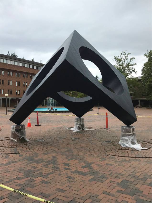
“Sky Viewing” by Isamu Noguchi ~ The first sculpture on the map, under construction.“Scepter” by Steve Tibbetts, 1966. I am amazed at the age of some of the sculptures. This is in Red Square about 30 feet from the previous one. It has stood there for many years, quietly observing campus life. I had to wonder if anyone takes much notice of it. It was one of my favorites.“Scepter” from another angle.Here are the previous two sculptures from across Red Square. You can just make out “Scepter” to the left of “Sky Viewing”“Wall Relief” by Norman Warsinske. This was difficult to find because I hadn’t expected a sculpture to be on a wall. There were supposed to be two of them, one on each end of the Humanities building, but……all I could find was where it’s pair had been.
Some of the sculptures are favorites of the students and visitors for obvious reasons…this would make a great walk for little people, as many of the sculptures are interactive, as you’ll see.
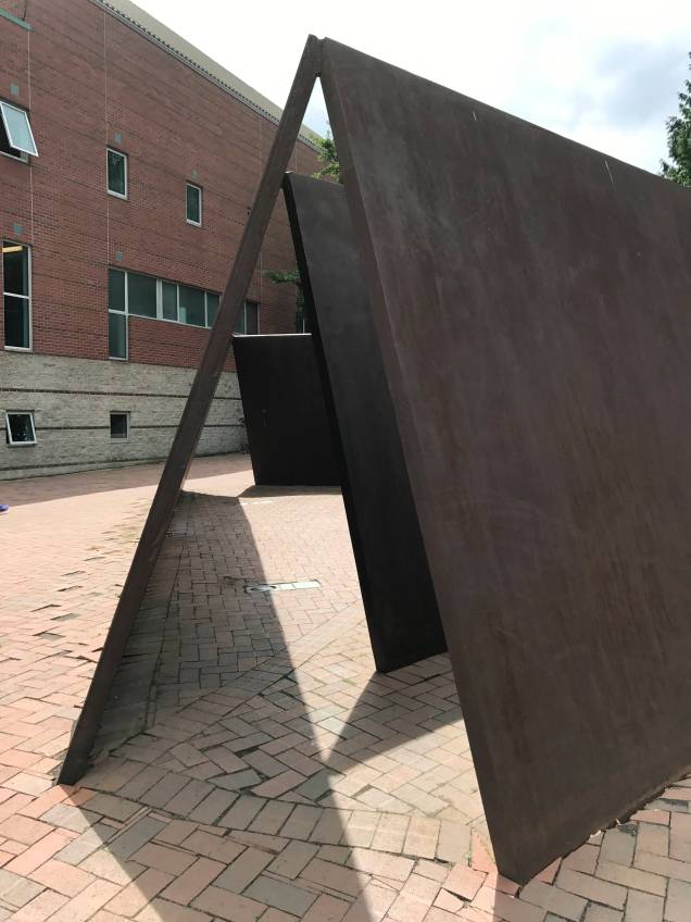
“The Man Who Used to Hunt Cougars for Bounty” by Richard Beyer“Bayview Station” by George Trakas. This was made from railroad track and wood, hence the name, Bayview Station. It also looked out over the bay, making a great hang out spot.“Bayview Station,” WWU Outdoor Sculpture Garden“Wright’s Triangle” by Richard Serra. This makes for an awesome hide and seek type game!
“Log Ramps” by Lloyd Hamrol. I think this is the same family that was climbing on one of the previous sculptures.“Stadium Piece” by Bruce Nauman. This one just makes you want to run to it. Kids were on it and under it…“Stadium Piece”
We’ve seen this next one for many years but have never gone up to it and inside it. It has a quality like no other. It is titled, “Stone Enclosure: Rock Rings” by Nancy Holt. I felt an inner quiet immediately come over me like never before.
“Stone Enclosure: Rock Rings” by Nancy Holt. The setting is breath-taking.“Stone Enclosure: Rock Rings”Looking all the way through to the green beyond…Contrast between styles…
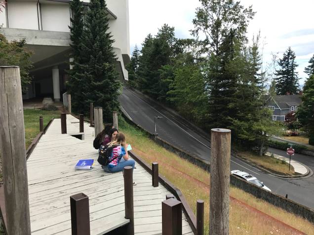
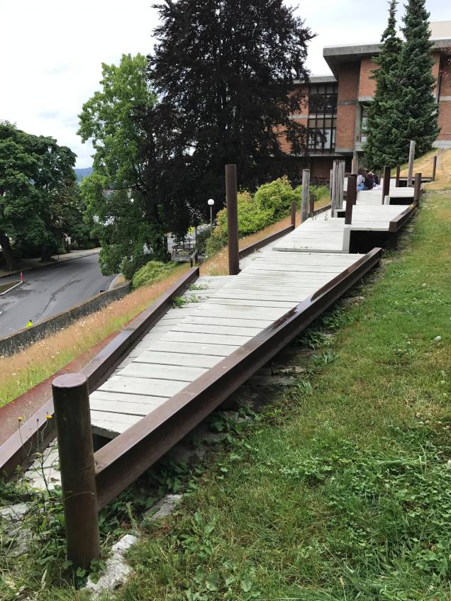
The map takes you all the way to Fairhaven College. This is not to be missed. The campus is designed in such a way that you feel you are at a mountain retreat. It would be great place to have a picnic lunch…
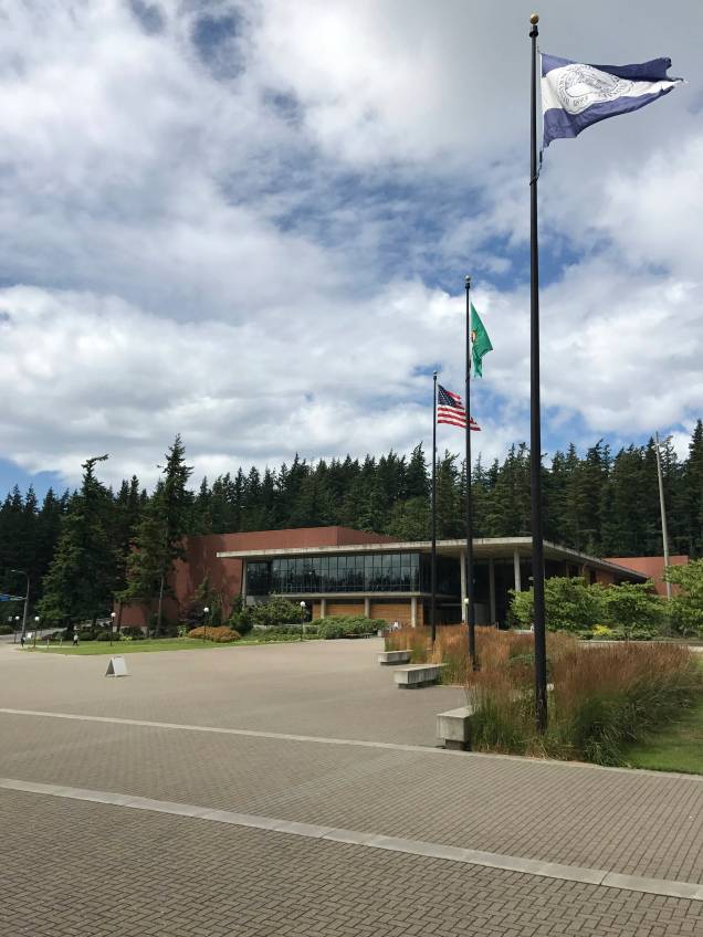
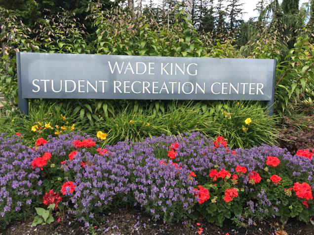
After Fairhaven College, you walk over to the state-of-the-art Wade King Student Recreation Center. Wade King lost his life as a youngster in the catastrophic Whatcom Falls Park fire. His family has given countless dollars, in his name, to promote the education of youth in Whatcom County. I was struck by the symmetry of the flags leading to the Center and the next sculpture, a water sculpture, dedicated to all those who served in WW II.
Wide open walkway leading to the Wade King Student Recreation Center, WWU
Here is a video of the water sculpture, “Rain Forest,” by James Fitzgerald at Wade King Student Recreation Center, WWU.
and another…
Here are a couple more of interest. One is inside the library. One is below a sky bridge of sorts, which given the layout of the sculpture was the best place to view it.
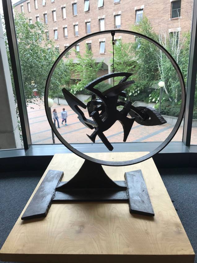
“Minds Eye” by Mark Di Suvero is inside the library. You can see it through the window as you approach.“Untitled” by Meg Webster as seen from above.These playful turtle-like characters, found in Haskell Plaza, are titled “Feats of Strength” by Tom Otterness.Pretty cute…
As you can see, this is a wonderful walk. The pictures in this post are just a handful of the entire collection. The campus is built on the side of a hill so the walker can get their muscles working. The sculptures are varied and artistically and thoughtfully created and placed. They are truly beautiful and inspiring. I ended up buying lunch from one of the vendors outside the student union and ate at a picnic table on the plaza outside the Performing Arts Center with it’s fabulous view of the bay. The book store is worth a look too. I was on campus for about 3 hours total. This is a wonderful walk for visitors and locals alike!
Happy Walking!
Yours Truly,
Ann
My lunch spot, with Bellingham Bay below, on the plaza outside The Performing Arts Center at Western Washington University, Bellingham, Washington